

194
S. K. Lahiri et al.
c
b
a
Courtesy: Sarma, 2005
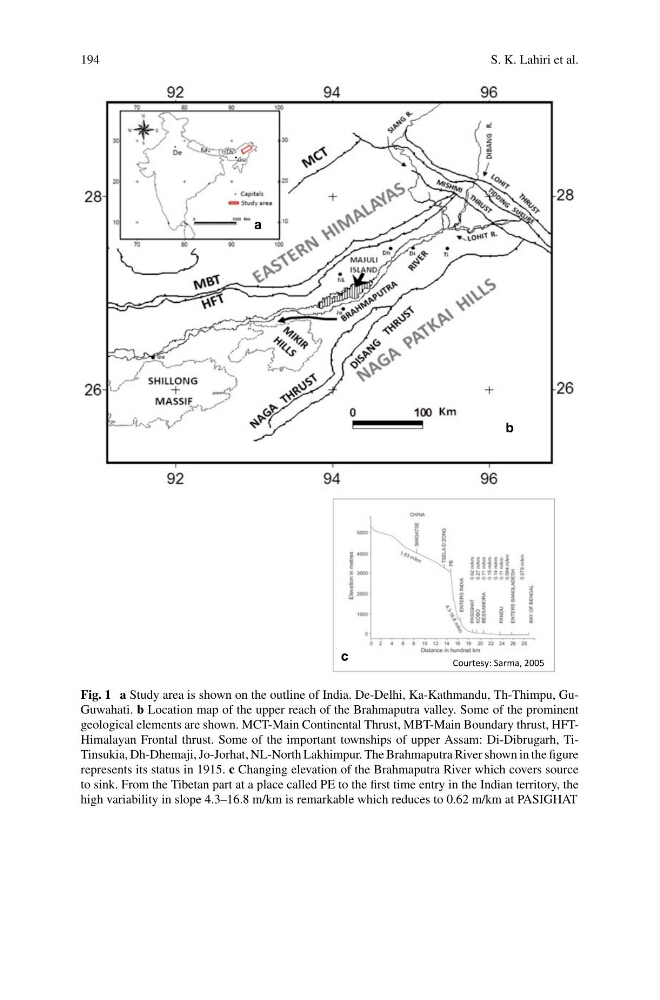
Fig. 1 a Study area is shown on the outline of India. De-Delhi, Ka-Kathmandu, Th-Thimpu, GuGuwahati. b Location map of the upper reach of the Brahmaputra valley. Some of the prominent
geological elements are shown. MCT-Main Continental Thrust, MBT-Main Boundary thrust, HFTHimalayan Frontal thrust. Some of the important townships of upper Assam: Di-Dibrugarh, TiTinsukia, Dh-Dhemaji, Jo-Jorhat, NL-North Lakhimpur. The Brahmaputra River shown in the figure
represents its status in 1915. c Changing elevation of the Brahmaputra River which covers source
to sink. From the Tibetan part at a place called PE to the first time entry in the Indian territory, the
high variability in slope 4.3–16.8 m/km is remarkable which reduces to 0.62 m/km at PASIGHAT
S. K. Lahiri et al.
c
b
a
Courtesy: Sarma, 2005
Fig. 1 a Study area is shown on the outline of India. De-Delhi, Ka-Kathmandu, Th-Thimpu, GuGuwahati. b Location map of the upper reach of the Brahmaputra valley. Some of the prominent
geological elements are shown. MCT-Main Continental Thrust, MBT-Main Boundary thrust, HFTHimalayan Frontal thrust. Some of the important townships of upper Assam: Di-Dibrugarh, TiTinsukia, Dh-Dhemaji, Jo-Jorhat, NL-North Lakhimpur. The Brahmaputra River shown in the figure
represents its status in 1915. c Changing elevation of the Brahmaputra River which covers source
to sink. From the Tibetan part at a place called PE to the first time entry in the Indian territory, the
high variability in slope 4.3–16.8 m/km is remarkable which reduces to 0.62 m/km at PASIGHAT