

138
S. Santra and S. Biswas
network in the area is derived from the flow accumulation layer. This method for
the creation of a drainage map from flow accumulation works on the probabilistic
approach and gives value for each possible flow line. These flow lines are used
to delineate possible streamlines. These generated rivers are then validated using
the satellite datasets [28]. After the validation, the GIS-based approach is used to
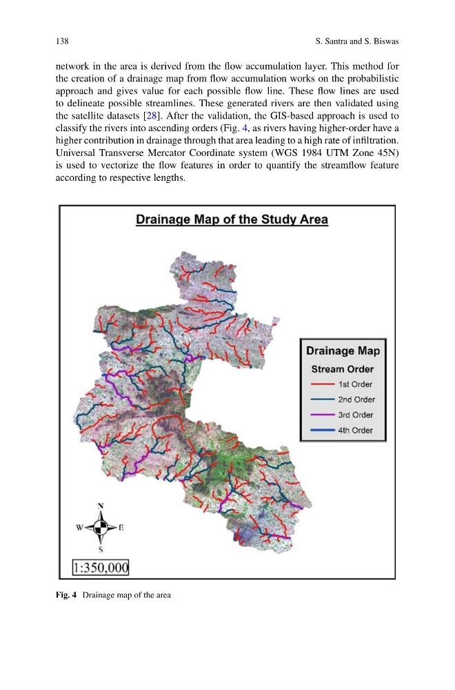
classify the rivers into ascending orders (Fig. 4, as rivers having higher-order have a
higher contribution in drainage through that area leading to a high rate of infiltration.
Universal Transverse Mercator Coordinate system (WGS 1984 UTM Zone 45N)
is used to vectorize the flow features in order to quantify the streamflow feature
according to respective lengths.
Fig. 4 Drainage map of the area
S. Santra and S. Biswas
network in the area is derived from the flow accumulation layer. This method for
the creation of a drainage map from flow accumulation works on the probabilistic
approach and gives value for each possible flow line. These flow lines are used
to delineate possible streamlines. These generated rivers are then validated using
the satellite datasets [28]. After the validation, the GIS-based approach is used to
classify the rivers into ascending orders (Fig. 4, as rivers having higher-order have a
higher contribution in drainage through that area leading to a high rate of infiltration.
Universal Transverse Mercator Coordinate system (WGS 1984 UTM Zone 45N)
is used to vectorize the flow features in order to quantify the streamflow feature
according to respective lengths.
Fig. 4 Drainage map of the area