

Study of Temporal Behaviour of Homogeneity Maps …
95
Table 1 Details of remote sensing datasets used in the study
S. No.
Product
Spatial
resolution
Temporal
resolution
Min value
in study
area
Max value
in study
area
Unit
1.
SRTM DEM
30 m
Static
120
143
m
2.
LAI MODIS
500 m
4 day
0.0000
1.3118
m 2 /m 2
3.
NDVI MODIS
250 m
16 day
0.2527
0.5515
4.
Evapotranspiration 1000 m
8 day
0.0000
16.0167
kg/m 2
5.
Soil moisture
SMAP
0.25 arc
degrees
3 day
11.3784
11.3784
%
6.
Rainfall TRMM
0.25 arc
degrees
1 Month
0.1040
0.1040
mm/hr
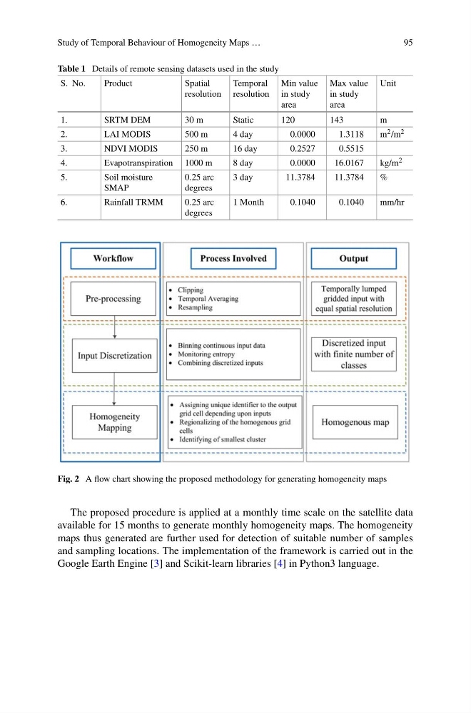
Fig. 2 A flow chart showing the proposed methodology for generating homogeneity maps
The proposed procedure is applied at a monthly time scale on the satellite data
available for 15 months to generate monthly homogeneity maps. The homogeneity
maps thus generated are further used for detection of suitable number of samples
and sampling locations. The implementation of the framework is carried out in the
Google Earth Engine [3] and Scikit-learn libraries [4] in Python3 language.
95
Table 1 Details of remote sensing datasets used in the study
S. No.
Product
Spatial
resolution
Temporal
resolution
Min value
in study
area
Max value
in study
area
Unit
1.
SRTM DEM
30 m
Static
120
143
m
2.
LAI MODIS
500 m
4 day
0.0000
1.3118
m 2 /m 2
3.
NDVI MODIS
250 m
16 day
0.2527
0.5515
4.
Evapotranspiration 1000 m
8 day
0.0000
16.0167
kg/m 2
5.
Soil moisture
SMAP
0.25 arc
degrees
3 day
11.3784
11.3784
%
6.
Rainfall TRMM
0.25 arc
degrees
1 Month
0.1040
0.1040
mm/hr
Fig. 2 A flow chart showing the proposed methodology for generating homogeneity maps
The proposed procedure is applied at a monthly time scale on the satellite data
available for 15 months to generate monthly homogeneity maps. The homogeneity
maps thus generated are further used for detection of suitable number of samples
and sampling locations. The implementation of the framework is carried out in the
Google Earth Engine [3] and Scikit-learn libraries [4] in Python3 language.