

13.2 Devices Originating Inside Versus Outside of the City
129
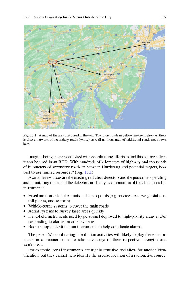
Fig. 13.1 A map of the area discussed in the text. The many roads in yellow are the highways; there
is also a network of secondary roads (white) as well as thousands of additional roads not shown
here
Imagine being the person tasked with coordinating efforts to find this source before
it can be used in an RDD. With hundreds of kilometers of highway and thousands
of kilometers of secondary roads to between Harrisburg and potential targets, how
best to use limited resources? (Fig. 13.1)
Available resources are the existing radiation detectors and the personnel operating
and monitoring them, and the detectors are likely a combination of fixed and portable
instruments:
• Fixed monitors at choke points and check points (e.g. service areas, weigh stations,
toll plazas, and so forth)
• Vehicle-borne systems to cover the main roads
• Aerial systems to survey large areas quickly
• Hand-held instruments used by personnel deployed to high-priority areas and/or
responding to alarms on other systems
• Radioisotopic identification instruments to help adjudicate alarms.
The person(s) coordinating interdiction activities will likely deploy these instruments in a manner so as to take advantage of their respective strengths and
weaknesses.
For example, aerial instruments are highly sensitive and allow for nuclide identification, but they cannot help identify the precise location of a radioactive source;
129
Fig. 13.1 A map of the area discussed in the text. The many roads in yellow are the highways; there
is also a network of secondary roads (white) as well as thousands of additional roads not shown
here
Imagine being the person tasked with coordinating efforts to find this source before
it can be used in an RDD. With hundreds of kilometers of highway and thousands
of kilometers of secondary roads to between Harrisburg and potential targets, how
best to use limited resources? (Fig. 13.1)
Available resources are the existing radiation detectors and the personnel operating
and monitoring them, and the detectors are likely a combination of fixed and portable
instruments:
• Fixed monitors at choke points and check points (e.g. service areas, weigh stations,
toll plazas, and so forth)
• Vehicle-borne systems to cover the main roads
• Aerial systems to survey large areas quickly
• Hand-held instruments used by personnel deployed to high-priority areas and/or
responding to alarms on other systems
• Radioisotopic identification instruments to help adjudicate alarms.
The person(s) coordinating interdiction activities will likely deploy these instruments in a manner so as to take advantage of their respective strengths and
weaknesses.
For example, aerial instruments are highly sensitive and allow for nuclide identification, but they cannot help identify the precise location of a radioactive source;