

233
he observes that geologists are aware that volcanoes are not local or isolated phenomena (“la generalità del vulcanismo (...) ha persuaso i geologi che la sede di
questi fenomeni non è locale o particolare, ma è generale”) and that the incandescent lava is not watery but highly viscous (“...la massa incandescente deve essere
non fluida, ma sommamente vischiosa”).
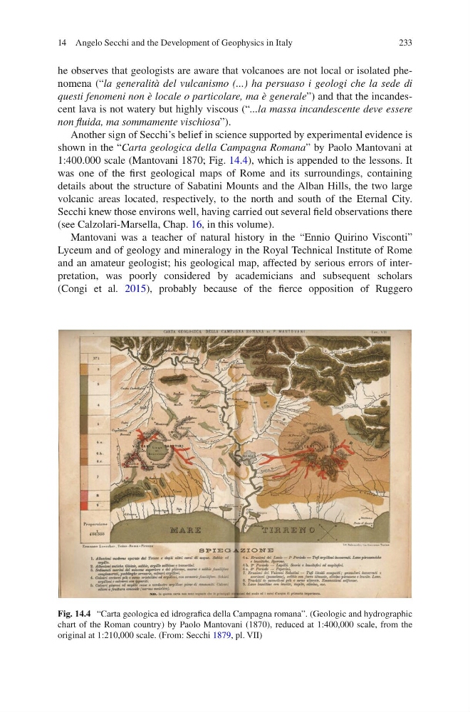
Another sign of Secchi’s belief in science supported by experimental evidence is
shown in the “Carta geologica della Campagna Romana” by Paolo Mantovani at
1:400.000 scale (Mantovani 1870; Fig. 14.4), which is appended to the lessons. It
was one of the first geological maps of Rome and its surroundings, containing
details about the structure of Sabatini Mounts and the Alban Hills, the two large
volcanic areas located, respectively, to the north and south of the Eternal City.
Secchi knew those environs well, having carried out several field observations there
(see Calzolari-Marsella, Chap. 16, in this volume).
Mantovani was a teacher of natural history in the “Ennio Quirino Visconti”
Lyceum and of geology and mineralogy in the Royal Technical Institute of Rome
and an amateur geologist; his geological map, affected by serious errors of interpretation, was poorly considered by academicians and subsequent scholars
(Congi et al. 2015), probably because of the fierce opposition of Ruggero
Fig. 14.4 “Carta geologica ed idrografica della Campagna romana”. (Geologic and hydrographic
chart of the Roman country) by Paolo Mantovani (1870), reduced at 1:400,000 scale, from the
original at 1:210,000 scale. (From: Secchi 1879, pl. VII)
14 Angelo Secchi and the Development of Geophysics in Italy
he observes that geologists are aware that volcanoes are not local or isolated phenomena (“la generalità del vulcanismo (...) ha persuaso i geologi che la sede di
questi fenomeni non è locale o particolare, ma è generale”) and that the incandescent lava is not watery but highly viscous (“...la massa incandescente deve essere
non fluida, ma sommamente vischiosa”).
Another sign of Secchi’s belief in science supported by experimental evidence is
shown in the “Carta geologica della Campagna Romana” by Paolo Mantovani at
1:400.000 scale (Mantovani 1870; Fig. 14.4), which is appended to the lessons. It
was one of the first geological maps of Rome and its surroundings, containing
details about the structure of Sabatini Mounts and the Alban Hills, the two large
volcanic areas located, respectively, to the north and south of the Eternal City.
Secchi knew those environs well, having carried out several field observations there
(see Calzolari-Marsella, Chap. 16, in this volume).
Mantovani was a teacher of natural history in the “Ennio Quirino Visconti”
Lyceum and of geology and mineralogy in the Royal Technical Institute of Rome
and an amateur geologist; his geological map, affected by serious errors of interpretation, was poorly considered by academicians and subsequent scholars
(Congi et al. 2015), probably because of the fierce opposition of Ruggero
Fig. 14.4 “Carta geologica ed idrografica della Campagna romana”. (Geologic and hydrographic
chart of the Roman country) by Paolo Mantovani (1870), reduced at 1:400,000 scale, from the
original at 1:210,000 scale. (From: Secchi 1879, pl. VII)
14 Angelo Secchi and the Development of Geophysics in Italy