

2000; Lionello et al. 2006; Trigo et al. 2006), ranging from the North Atlantic
midlatitudes storm track in winter (e.g., Hurrell 1995), to tropical systems such as
the Hadley Cell throughout its descending branch along many months of the year, or
the African and the remote Asian monsoons in summer (Rodwell and Hoskins
2001). Therefore, the climate of the Alboran area is mostly characterized by mild
wet “winters” (from October to April); warm to hot and very dry summers (from
June to August), liable to heat waves and forest fires, and overall semiarid conditions
35°N
–6000 –5000 –4000 –3000 –2000 –1000 5°W 0
m
1000
2000
3000
4000
5000 6000
–6000
20°N
20°W
10°W
0°
10°E
20°E
30°E
40°E
50°E
60°E
30°N
40°N
50°N
–5000 –4000
–3000 –2000 –1000
0
m
1000
2000
3000
4000
5000
6000
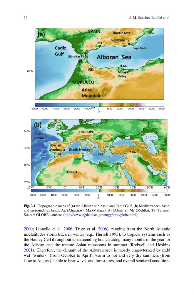
Fig. 3.1 Topographic maps of (a) the Alboran sub-basin and Cádiz Gulf, (b) Mediterranean basin,
and surroundings lands. Ag (Algeciras); Ma (Malaga); Al (Almeria); Me (Melilla); Ta (Tanger).
Source: GLOBE database (http://www.ngdc.noaa.gov/mgg/topo/globe.html)
32
J. M. Sánchez-Laulhé et al.
midlatitudes storm track in winter (e.g., Hurrell 1995), to tropical systems such as
the Hadley Cell throughout its descending branch along many months of the year, or
the African and the remote Asian monsoons in summer (Rodwell and Hoskins
2001). Therefore, the climate of the Alboran area is mostly characterized by mild
wet “winters” (from October to April); warm to hot and very dry summers (from
June to August), liable to heat waves and forest fires, and overall semiarid conditions
35°N
–6000 –5000 –4000 –3000 –2000 –1000 5°W 0
m
1000
2000
3000
4000
5000 6000
–6000
20°N
20°W
10°W
0°
10°E
20°E
30°E
40°E
50°E
60°E
30°N
40°N
50°N
–5000 –4000
–3000 –2000 –1000
0
m
1000
2000
3000
4000
5000
6000
Fig. 3.1 Topographic maps of (a) the Alboran sub-basin and Cádiz Gulf, (b) Mediterranean basin,
and surroundings lands. Ag (Algeciras); Ma (Malaga); Al (Almeria); Me (Melilla); Ta (Tanger).
Source: GLOBE database (http://www.ngdc.noaa.gov/mgg/topo/globe.html)
32
J. M. Sánchez-Laulhé et al.