

7 A Framework for IWRM in the Water-Energy-Food …
147
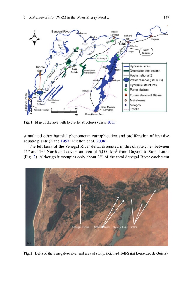
Fig. 1 Map of the area with hydraulic structures (Cissé 2011)
stimulated other harmful phenomena: eutrophication and proliferation of invasive
aquatic plants (Kane 1997; Mietton et al. 2008).
The left bank of the Senegal River delta, discussed in this chapter, lies between
15° and 16° North and covers an area of 5,000 km
2 from Dagana to Saint-Louis
(Fig. 2). Although it occupies only about 3% of the total Senegal River catchment
Fig. 2 Delta of the Senegalese river and area of study: (Richard Toll-Saint Louis-Lac de Guiers)
147
Fig. 1 Map of the area with hydraulic structures (Cissé 2011)
stimulated other harmful phenomena: eutrophication and proliferation of invasive
aquatic plants (Kane 1997; Mietton et al. 2008).
The left bank of the Senegal River delta, discussed in this chapter, lies between
15° and 16° North and covers an area of 5,000 km
2 from Dagana to Saint-Louis
(Fig. 2). Although it occupies only about 3% of the total Senegal River catchment
Fig. 2 Delta of the Senegalese river and area of study: (Richard Toll-Saint Louis-Lac de Guiers)