

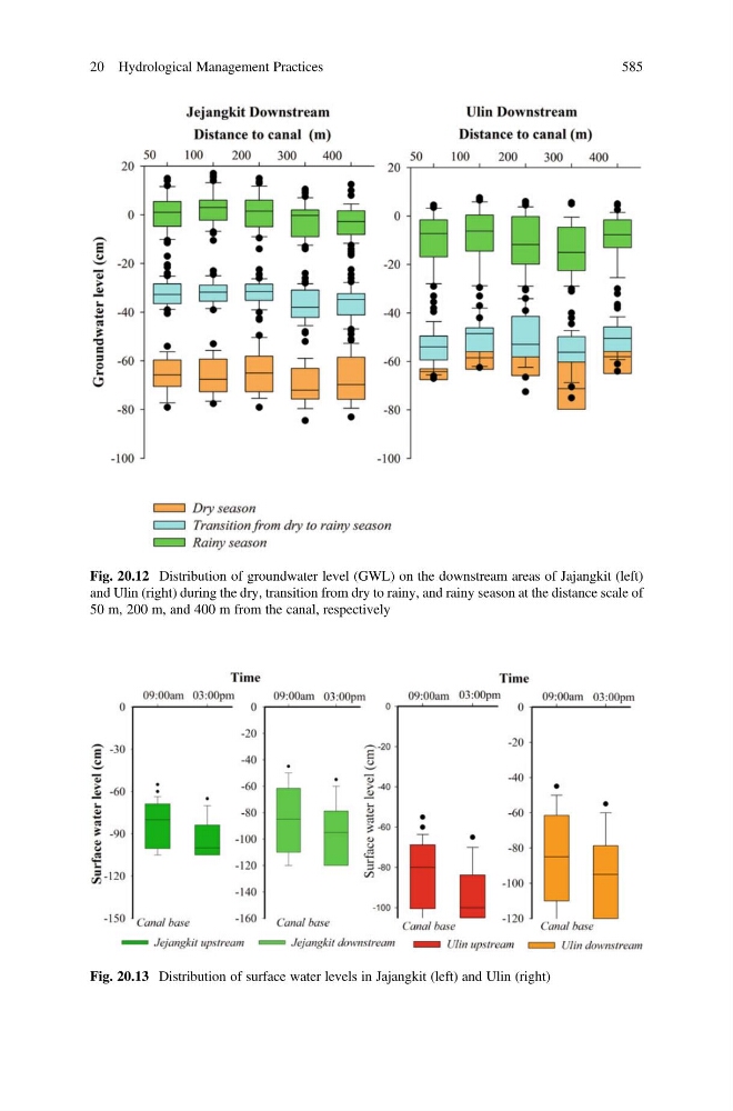
Fig. 20.12 Distribution of groundwater level (GWL) on the downstream areas of Jajangkit (left)
and Ulin (right) during the dry, transition from dry to rainy, and rainy season at the distance scale of
50 m, 200 m, and 400 m from the canal, respectively
Fig. 20.13 Distribution of surface water levels in Jajangkit (left) and Ulin (right)
20 Hydrological Management Practices
585
and Ulin (right) during the dry, transition from dry to rainy, and rainy season at the distance scale of
50 m, 200 m, and 400 m from the canal, respectively
Fig. 20.13 Distribution of surface water levels in Jajangkit (left) and Ulin (right)
20 Hydrological Management Practices
585