

The average monthly temperature was 31.6
C from 2012 to 2018 in five stations
and ranged from a low of 27.4
C to a high of 36.8
C. Between concessions, WSL
had a slightly higher temperature than MTI, as well as a higher annual rainfall. It is
presumed that the distance from the sea may affect the high temperature and rainfall
of WSL because those climate observation results were lower in the inland area,
known as the land-sea breeze.
The total rainfall and its pattern showed a spatial difference in the concessions
(unpublished data). Although seasonal shifts in the location of the ITCZ drastically
affects rainfall pattern in many equatorial nations, the differences at the local level
may be generated by microtopography and vegetation in addition to the effect of
land-sea breeze.
3.10.3 Monitoring of Peat Characteristics
Facilities were established for “Eco-management in a Large-scale Ecosystem of
Tropical Peatland” based on concept of the “Stock-based water management” (see
Chap. 2). Subsequently, it is necessary to evaluate whether facilities are functional or
not, and the monitoring system was established as follows.
3.10.3.1 Groundwater Level (GWL)
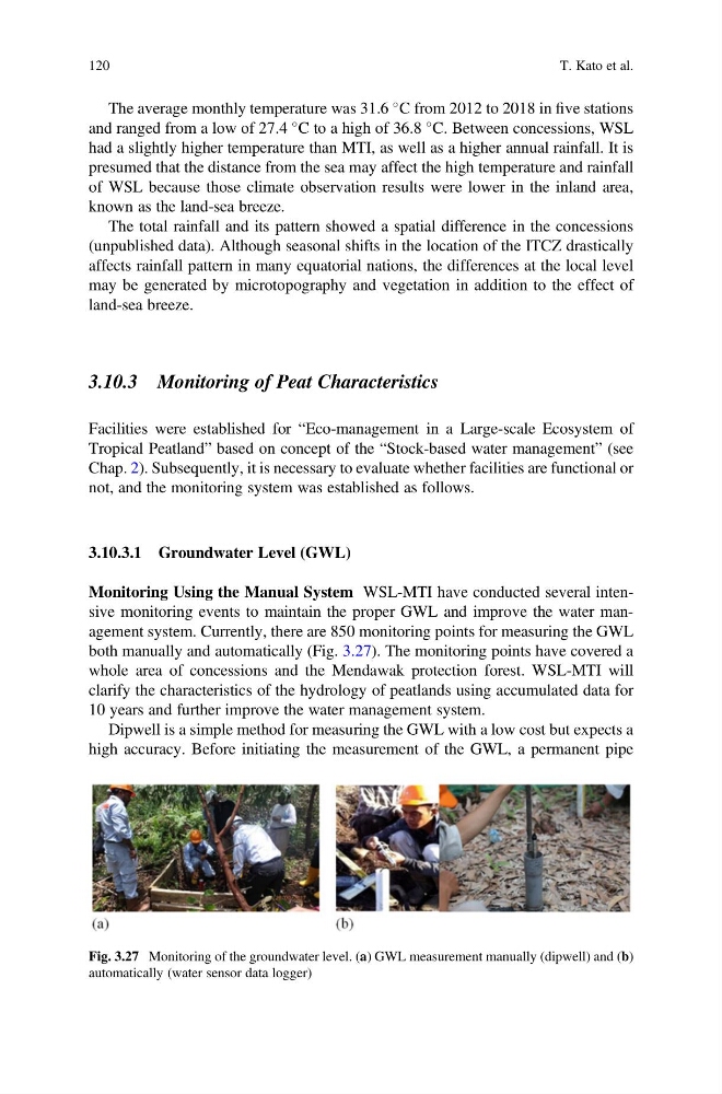
Monitoring Using the Manual System WSL-MTI have conducted several intensive monitoring events to maintain the proper GWL and improve the water management system. Currently, there are 850 monitoring points for measuring the GWL
both manually and automatically (Fig. 3.27). The monitoring points have covered a
whole area of concessions and the Mendawak protection forest. WSL-MTI will
clarify the characteristics of the hydrology of peatlands using accumulated data for
10 years and further improve the water management system.
Dipwell is a simple method for measuring the GWL with a low cost but expects a
high accuracy. Before initiating the measurement of the GWL, a permanent pipe
Fig. 3.27 Monitoring of the groundwater level. (a) GWL measurement manually (dipwell) and (b)
automatically (water sensor data logger)
120
T. Kato et al.
C from 2012 to 2018 in five stations
and ranged from a low of 27.4
C to a high of 36.8
C. Between concessions, WSL
had a slightly higher temperature than MTI, as well as a higher annual rainfall. It is
presumed that the distance from the sea may affect the high temperature and rainfall
of WSL because those climate observation results were lower in the inland area,
known as the land-sea breeze.
The total rainfall and its pattern showed a spatial difference in the concessions
(unpublished data). Although seasonal shifts in the location of the ITCZ drastically
affects rainfall pattern in many equatorial nations, the differences at the local level
may be generated by microtopography and vegetation in addition to the effect of
land-sea breeze.
3.10.3 Monitoring of Peat Characteristics
Facilities were established for “Eco-management in a Large-scale Ecosystem of
Tropical Peatland” based on concept of the “Stock-based water management” (see
Chap. 2). Subsequently, it is necessary to evaluate whether facilities are functional or
not, and the monitoring system was established as follows.
3.10.3.1 Groundwater Level (GWL)
Monitoring Using the Manual System WSL-MTI have conducted several intensive monitoring events to maintain the proper GWL and improve the water management system. Currently, there are 850 monitoring points for measuring the GWL
both manually and automatically (Fig. 3.27). The monitoring points have covered a
whole area of concessions and the Mendawak protection forest. WSL-MTI will
clarify the characteristics of the hydrology of peatlands using accumulated data for
10 years and further improve the water management system.
Dipwell is a simple method for measuring the GWL with a low cost but expects a
high accuracy. Before initiating the measurement of the GWL, a permanent pipe
Fig. 3.27 Monitoring of the groundwater level. (a) GWL measurement manually (dipwell) and (b)
automatically (water sensor data logger)
120
T. Kato et al.