

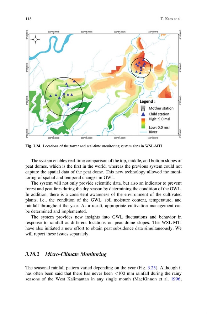
The system enables real-time comparison of the top, middle, and bottom slopes of
peat domes, which is the first in the world, whereas the previous system could not
capture the spatial data of the peat dome. This new technology allowed the monitoring of spatial and temporal changes in GWL.
The system will not only provide scientific data, but also an indicator to prevent
forest and peat fires during the dry season by determining the condition of the GWL.
In addition, there is a consistent awareness of the environment of the cultivated
plants, i.e., the condition of the GWL, soil moisture content, temperature, and
rainfall throughout the year. As a result, appropriate cultivation management can
be determined and implemented.
The system provides new insights into GWL fluctuations and behavior in
response to rainfall at different locations on peat dome slopes. The WSL-MTI
have also initiated a new effort to obtain peat subsidence data simultaneously. We
will report these issues separately.
3.10.2 Micro-Climate Monitoring
The seasonal rainfall pattern varied depending on the year (Fig. 3.25). Although it
has often been said that there has never been <100 mm rainfall during the rainy
seasons of the West Kalimantan in any single month (MacKinnon et al. 1996;
Fig. 3.24 Locations of the tower and real-time monitoring system sites in WSL-MTI
118
T. Kato et al.
peat domes, which is the first in the world, whereas the previous system could not
capture the spatial data of the peat dome. This new technology allowed the monitoring of spatial and temporal changes in GWL.
The system will not only provide scientific data, but also an indicator to prevent
forest and peat fires during the dry season by determining the condition of the GWL.
In addition, there is a consistent awareness of the environment of the cultivated
plants, i.e., the condition of the GWL, soil moisture content, temperature, and
rainfall throughout the year. As a result, appropriate cultivation management can
be determined and implemented.
The system provides new insights into GWL fluctuations and behavior in
response to rainfall at different locations on peat dome slopes. The WSL-MTI
have also initiated a new effort to obtain peat subsidence data simultaneously. We
will report these issues separately.
3.10.2 Micro-Climate Monitoring
The seasonal rainfall pattern varied depending on the year (Fig. 3.25). Although it
has often been said that there has never been <100 mm rainfall during the rainy
seasons of the West Kalimantan in any single month (MacKinnon et al. 1996;
Fig. 3.24 Locations of the tower and real-time monitoring system sites in WSL-MTI
118
T. Kato et al.