

18.6 Method of Inundation Zone
Outline Calculation in Case
of River Flood Situation
Under the development of the integrated
approach for spring time river flood forecast, the
new geometric algorithm of inundation zone
outline calculation was proposed, which simulates the flood water spread from the river
directly over the terrain digital elevation model
(DEM) raster elements.
The proposed algorithm includes three phases:
(a) The river center line is projected over the
DEM;
(b) The water elevation in the river center line pixels
is calculated as a result of linear interpolation
between the water elevations registered by the
neighboring stream flow measuring stations;
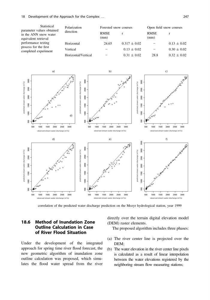
Fig. 18.9 correlation of the predicted water discharge prediction on the Mozyr hydrological station, year 1999
Table 18.1 Statistical
parameter values obtained
in the ANN snow water
equivalent retrieval
performance testing
process for the first
completed experiment
Polarization
direction
Forested snow courses
Open field snow courses
RMSE
(mm)
r
RMSE
(mm)
r
Horizontal
24.65
0.317 ± 0.02
−
0.13 ± 0.02
Vertical
−
0.13 ± 0.02
−
0.30 ± 0.02
Horizontal/Vertical
−
0.31 ± 0.02
28.8
0.32 ± 0.02
18 Development of the Approach for the Complex …
247
Outline Calculation in Case
of River Flood Situation
Under the development of the integrated
approach for spring time river flood forecast, the
new geometric algorithm of inundation zone
outline calculation was proposed, which simulates the flood water spread from the river
directly over the terrain digital elevation model
(DEM) raster elements.
The proposed algorithm includes three phases:
(a) The river center line is projected over the
DEM;
(b) The water elevation in the river center line pixels
is calculated as a result of linear interpolation
between the water elevations registered by the
neighboring stream flow measuring stations;
Fig. 18.9 correlation of the predicted water discharge prediction on the Mozyr hydrological station, year 1999
Table 18.1 Statistical
parameter values obtained
in the ANN snow water
equivalent retrieval
performance testing
process for the first
completed experiment
Polarization
direction
Forested snow courses
Open field snow courses
RMSE
(mm)
r
RMSE
(mm)
r
Horizontal
24.65
0.317 ± 0.02
−
0.13 ± 0.02
Vertical
−
0.13 ± 0.02
−
0.30 ± 0.02
Horizontal/Vertical
−
0.31 ± 0.02
28.8
0.32 ± 0.02
18 Development of the Approach for the Complex …
247