

366
M. Gor˛ aczko and K. Kubiak-Wójcicka
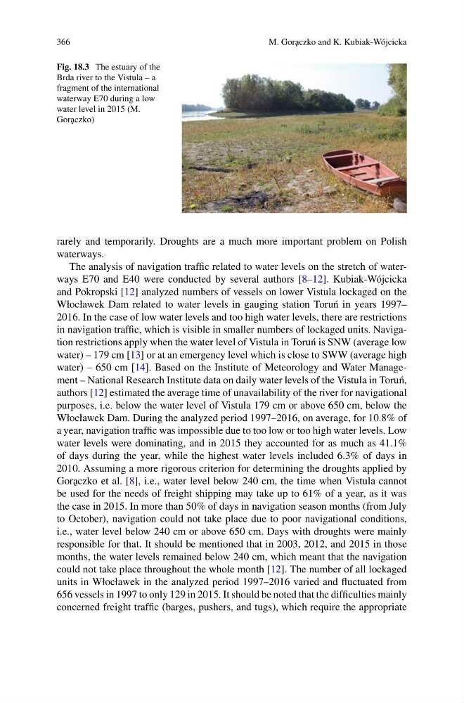
Fig. 18.3 The estuary of the
Brda river to the Vistula – a
fragment of the international
waterway E70 during a low
water level in 2015 (M.
Gor˛ aczko)
rarely and temporarily. Droughts are a much more important problem on Polish
waterways.
The analysis of navigation traffic related to water levels on the stretch of waterways E70 and E40 were conducted by several authors [8–12]. Kubiak-Wójcicka
and Pokropski [12] analyzed numbers of vessels on lower Vistula lockaged on the
Włocławek Dam related to water levels in gauging station Toru´ n in years 1997–
2016. In the case of low water levels and too high water levels, there are restrictions
in navigation traffic, which is visible in smaller numbers of lockaged units. Navigation restrictions apply when the water level of Vistula in Toru´ n is SNW (average low
water) – 179 cm [13] or at an emergency level which is close to SWW (average high
water) – 650 cm [14]. Based on the Institute of Meteorology and Water Management – National Research Institute data on daily water levels of the Vistula in Toru´ n,
authors [12] estimated the average time of unavailability of the river for navigational
purposes, i.e. below the water level of Vistula 179 cm or above 650 cm, below the
Włocławek Dam. During the analyzed period 1997–2016, on average, for 10.8% of
a year, navigation traffic was impossible due to too low or too high water levels. Low
water levels were dominating, and in 2015 they accounted for as much as 41.1%
of days during the year, while the highest water levels included 6.3% of days in
2010. Assuming a more rigorous criterion for determining the droughts applied by
Gor˛ aczko et al. [8], i.e., water level below 240 cm, the time when Vistula cannot
be used for the needs of freight shipping may take up to 61% of a year, as it was
the case in 2015. In more than 50% of days in navigation season months (from July
to October), navigation could not take place due to poor navigational conditions,
i.e., water level below 240 cm or above 650 cm. Days with droughts were mainly
responsible for that. It should be mentioned that in 2003, 2012, and 2015 in those
months, the water levels remained below 240 cm, which meant that the navigation
could not take place throughout the whole month [12]. The number of all lockaged
units in Włocławek in the analyzed period 1997–2016 varied and fluctuated from
656 vessels in 1997 to only 129 in 2015. It should be noted that the difficulties mainly
concerned freight traffic (barges, pushers, and tugs), which require the appropriate
M. Gor˛ aczko and K. Kubiak-Wójcicka
Fig. 18.3 The estuary of the
Brda river to the Vistula – a
fragment of the international
waterway E70 during a low
water level in 2015 (M.
Gor˛ aczko)
rarely and temporarily. Droughts are a much more important problem on Polish
waterways.
The analysis of navigation traffic related to water levels on the stretch of waterways E70 and E40 were conducted by several authors [8–12]. Kubiak-Wójcicka
and Pokropski [12] analyzed numbers of vessels on lower Vistula lockaged on the
Włocławek Dam related to water levels in gauging station Toru´ n in years 1997–
2016. In the case of low water levels and too high water levels, there are restrictions
in navigation traffic, which is visible in smaller numbers of lockaged units. Navigation restrictions apply when the water level of Vistula in Toru´ n is SNW (average low
water) – 179 cm [13] or at an emergency level which is close to SWW (average high
water) – 650 cm [14]. Based on the Institute of Meteorology and Water Management – National Research Institute data on daily water levels of the Vistula in Toru´ n,
authors [12] estimated the average time of unavailability of the river for navigational
purposes, i.e. below the water level of Vistula 179 cm or above 650 cm, below the
Włocławek Dam. During the analyzed period 1997–2016, on average, for 10.8% of
a year, navigation traffic was impossible due to too low or too high water levels. Low
water levels were dominating, and in 2015 they accounted for as much as 41.1%
of days during the year, while the highest water levels included 6.3% of days in
2010. Assuming a more rigorous criterion for determining the droughts applied by
Gor˛ aczko et al. [8], i.e., water level below 240 cm, the time when Vistula cannot
be used for the needs of freight shipping may take up to 61% of a year, as it was
the case in 2015. In more than 50% of days in navigation season months (from July
to October), navigation could not take place due to poor navigational conditions,
i.e., water level below 240 cm or above 650 cm. Days with droughts were mainly
responsible for that. It should be mentioned that in 2003, 2012, and 2015 in those
months, the water levels remained below 240 cm, which meant that the navigation
could not take place throughout the whole month [12]. The number of all lockaged
units in Włocławek in the analyzed period 1997–2016 varied and fluctuated from
656 vessels in 1997 to only 129 in 2015. It should be noted that the difficulties mainly
concerned freight traffic (barges, pushers, and tugs), which require the appropriate