

306
J. Fac-Beneda et al.
16.1 Characteristic of the Pomeranian Catchments
The catchments located between the basins of the Odra and Vistula are referred to
as Pomeranian [1] and cover part of the Coastal region and the South-Baltic Lake
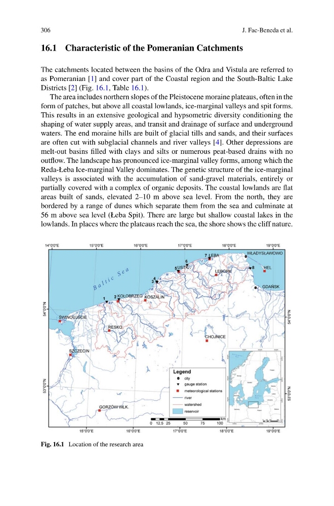
Districts [2] (Fig. 16.1, Table 16.1).
The area includes northern slopes of the Pleistocene moraine plateaus, often in the
form of patches, but above all coastal lowlands, ice-marginal valleys and spit forms.
This results in an extensive geological and hypsometric diversity conditioning the
shaping of water supply areas, and transit and drainage of surface and underground
waters. The end moraine hills are built of glacial tills and sands, and their surfaces
are often cut with subglacial channels and river valleys [4]. Other depressions are
melt-out basins filled with clays and silts or numerous peat-based drains with no
outflow. The landscape has pronounced ice-marginal valley forms, among which the
Reda-Łeba Ice-marginal Valley dominates. The genetic structure of the ice-marginal
valleys is associated with the accumulation of sand-gravel materials, entirely or
partially covered with a complex of organic deposits. The coastal lowlands are flat
areas built of sands, elevated 2–10 m above sea level. From the north, they are
bordered by a range of dunes which separate them from the sea and culminate at
56 m above sea level (Łeba Spit). There are large but shallow coastal lakes in the
lowlands. In places where the plateaus reach the sea, the shore shows the cliff nature.
Fig. 16.1 Location of the research area
J. Fac-Beneda et al.
16.1 Characteristic of the Pomeranian Catchments
The catchments located between the basins of the Odra and Vistula are referred to
as Pomeranian [1] and cover part of the Coastal region and the South-Baltic Lake
Districts [2] (Fig. 16.1, Table 16.1).
The area includes northern slopes of the Pleistocene moraine plateaus, often in the
form of patches, but above all coastal lowlands, ice-marginal valleys and spit forms.
This results in an extensive geological and hypsometric diversity conditioning the
shaping of water supply areas, and transit and drainage of surface and underground
waters. The end moraine hills are built of glacial tills and sands, and their surfaces
are often cut with subglacial channels and river valleys [4]. Other depressions are
melt-out basins filled with clays and silts or numerous peat-based drains with no
outflow. The landscape has pronounced ice-marginal valley forms, among which the
Reda-Łeba Ice-marginal Valley dominates. The genetic structure of the ice-marginal
valleys is associated with the accumulation of sand-gravel materials, entirely or
partially covered with a complex of organic deposits. The coastal lowlands are flat
areas built of sands, elevated 2–10 m above sea level. From the north, they are
bordered by a range of dunes which separate them from the sea and culminate at
56 m above sea level (Łeba Spit). There are large but shallow coastal lakes in the
lowlands. In places where the plateaus reach the sea, the shore shows the cliff nature.
Fig. 16.1 Location of the research area