

15 Flood Risk Management System in Poland
291
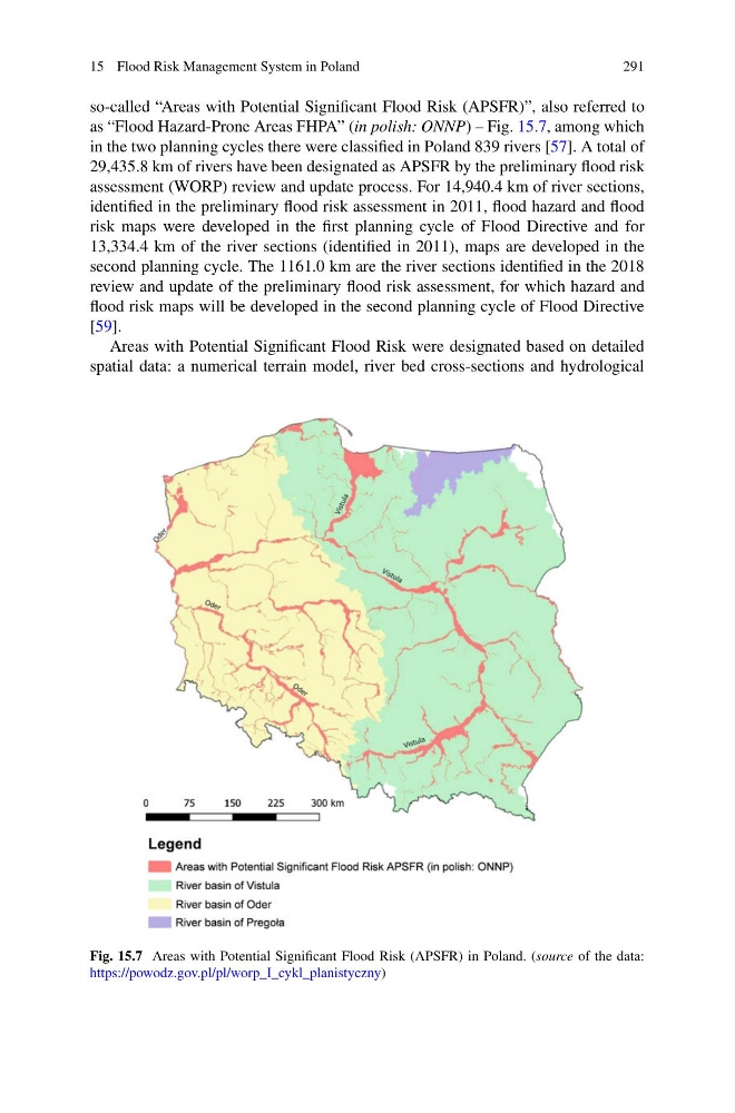
so-called “Areas with Potential Significant Flood Risk (APSFR)”, also referred to
as “Flood Hazard-Prone Areas FHPA” (in polish: ONNP) – Fig. 15.7, among which
in the two planning cycles there were classified in Poland 839 rivers [57]. A total of
29,435.8 km of rivers have been designated as APSFR by the preliminary flood risk
assessment (WORP) review and update process. For 14,940.4 km of river sections,
identified in the preliminary flood risk assessment in 2011, flood hazard and flood
risk maps were developed in the first planning cycle of Flood Directive and for
13,334.4 km of the river sections (identified in 2011), maps are developed in the
second planning cycle. The 1161.0 km are the river sections identified in the 2018
review and update of the preliminary flood risk assessment, for which hazard and
flood risk maps will be developed in the second planning cycle of Flood Directive
[59].
Areas with Potential Significant Flood Risk were designated based on detailed
spatial data: a numerical terrain model, river bed cross-sections and hydrological
Fig. 15.7 Areas with Potential Significant Flood Risk (APSFR) in Poland. (source of the data:
https://powodz.gov.pl/pl/worp_I_cykl_planistyczny)
291
so-called “Areas with Potential Significant Flood Risk (APSFR)”, also referred to
as “Flood Hazard-Prone Areas FHPA” (in polish: ONNP) – Fig. 15.7, among which
in the two planning cycles there were classified in Poland 839 rivers [57]. A total of
29,435.8 km of rivers have been designated as APSFR by the preliminary flood risk
assessment (WORP) review and update process. For 14,940.4 km of river sections,
identified in the preliminary flood risk assessment in 2011, flood hazard and flood
risk maps were developed in the first planning cycle of Flood Directive and for
13,334.4 km of the river sections (identified in 2011), maps are developed in the
second planning cycle. The 1161.0 km are the river sections identified in the 2018
review and update of the preliminary flood risk assessment, for which hazard and
flood risk maps will be developed in the second planning cycle of Flood Directive
[59].
Areas with Potential Significant Flood Risk were designated based on detailed
spatial data: a numerical terrain model, river bed cross-sections and hydrological
Fig. 15.7 Areas with Potential Significant Flood Risk (APSFR) in Poland. (source of the data:
https://powodz.gov.pl/pl/worp_I_cykl_planistyczny)