

11 Low-Flows in Polish Rivers
209
q min minimum discharge during low-flow episode [dm
3 ·s
−1 ·km
– 2 ],
ReT low-flow discharge recession time [days].
The dynamics of receding of the low-flow episode was estimated based on the
low-flow discharge rise rate:
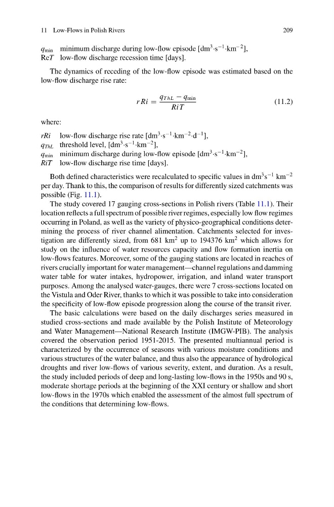
r Ri =
q T hL − q min
Ri T
(11.2)
where:
rRi low-flow discharge rise rate [dm
3 ·s
−1 ·km
−2 ·d
−1 ],
q ThL threshold level, [dm
3 ·s
−1 ·km
−2 ],
q min minimum discharge during low-flow episode [dm
3 ·s
−1 ·km
−2 ],
RiT low-flow discharge rise time [days].
Both defined characteristics were recalculated to specific values in dm
3 s
−1 km
−2
per day. Thank to this, the comparison of results for differently sized catchments was
possible (Fig. 11.1).
The study covered 17 gauging cross-sections in Polish rivers (Table 11.1). Their
location reflects a full spectrum of possible river regimes, especially low flow regimes
occurring in Poland, as well as the variety of physico-geographical conditions determining the process of river channel alimentation. Catchments selected for investigation are differently sized, from 681 km
2 up to 194376 km
2 which allows for
study on the influence of water resources capacity and flow formation inertia on
low-flows features. Moreover, some of the gauging stations are located in reaches of
rivers crucially important for water management—channel regulations and damming
water table for water intakes, hydropower, irrigation, and inland water transport
purposes. Among the analysed water-gauges, there were 7 cross-sections located on
the Vistula and Oder River, thanks to which it was possible to take into consideration
the specificity of low-flow episode progression along the course of the transit river.
The basic calculations were based on the daily discharges series measured in
studied cross-sections and made available by the Polish Institute of Meteorology
and Water Management—National Research Institute (IMGW-PIB). The analysis
covered the observation period 1951-2015. The presented multiannual period is
characterized by the occurrence of seasons with various moisture conditions and
various structures of the water balance, and thus also the appearance of hydrological
droughts and river low-flows of various severity, extent, and duration. As a result,
the study included periods of deep and long-lasting low-flows in the 1950s and 90 s,
moderate shortage periods at the beginning of the XXI century or shallow and short
low-flows in the 1970s which enabled the assessment of the almost full spectrum of
the conditions that determining low-flows.
209
q min minimum discharge during low-flow episode [dm
3 ·s
−1 ·km
– 2 ],
ReT low-flow discharge recession time [days].
The dynamics of receding of the low-flow episode was estimated based on the
low-flow discharge rise rate:
r Ri =
q T hL − q min
Ri T
(11.2)
where:
rRi low-flow discharge rise rate [dm
3 ·s
−1 ·km
−2 ·d
−1 ],
q ThL threshold level, [dm
3 ·s
−1 ·km
−2 ],
q min minimum discharge during low-flow episode [dm
3 ·s
−1 ·km
−2 ],
RiT low-flow discharge rise time [days].
Both defined characteristics were recalculated to specific values in dm
3 s
−1 km
−2
per day. Thank to this, the comparison of results for differently sized catchments was
possible (Fig. 11.1).
The study covered 17 gauging cross-sections in Polish rivers (Table 11.1). Their
location reflects a full spectrum of possible river regimes, especially low flow regimes
occurring in Poland, as well as the variety of physico-geographical conditions determining the process of river channel alimentation. Catchments selected for investigation are differently sized, from 681 km
2 up to 194376 km
2 which allows for
study on the influence of water resources capacity and flow formation inertia on
low-flows features. Moreover, some of the gauging stations are located in reaches of
rivers crucially important for water management—channel regulations and damming
water table for water intakes, hydropower, irrigation, and inland water transport
purposes. Among the analysed water-gauges, there were 7 cross-sections located on
the Vistula and Oder River, thanks to which it was possible to take into consideration
the specificity of low-flow episode progression along the course of the transit river.
The basic calculations were based on the daily discharges series measured in
studied cross-sections and made available by the Polish Institute of Meteorology
and Water Management—National Research Institute (IMGW-PIB). The analysis
covered the observation period 1951-2015. The presented multiannual period is
characterized by the occurrence of seasons with various moisture conditions and
various structures of the water balance, and thus also the appearance of hydrological
droughts and river low-flows of various severity, extent, and duration. As a result,
the study included periods of deep and long-lasting low-flows in the 1950s and 90 s,
moderate shortage periods at the beginning of the XXI century or shallow and short
low-flows in the 1970s which enabled the assessment of the almost full spectrum of
the conditions that determining low-flows.