

300
(Argemone mexicana) and dhutura (Datura metel) are the common species of these
waste grounds and uplands.
A small patch of 1.90 ha (0.66%) of barren rocky/stony wastes is noticed amidst
this scrubland along the stream Mara Jhor. Locally well-known villagers Siblal
Soren and Dr. Subhas Chandra Pal stated that there was a hilly tract at the position
of that small patch in earlier, after which the name ‘Geruapahari’ had been given.
But in the later period, the land was totally converted into rocky wastes by stone
quarrying for building materials purposes. Only some disintegrated basaltic rock
fragments are lying as remnants of that ancient hilly tract. The inner areas are partly
covered with grasses and isolated trees among which stunted palash (Butea monosperma) is most common.
17.7.2 Type 2: Undulating Uplands with Scrub –
Barajor Village
As per physiographic division of NBSS & LUP, the area is under alluvial plain more
precisely flood plain. The River Ajay forms the southern borderline of the village as
well as the whole Block which separates the area from the district Burdwan. Apart
from this river, there is also an ephemeral drainage channel locally named as Kasai
Kandar, touched the village in the northern part. A contour line of 80 m has gone
through the northern part of the village representing that the average elevation of the
area is less than 80 m.
The remarkable feature of the site is about half (50.20%) of the village is under
four different types of wastelands among which the sandy area and the scrubland
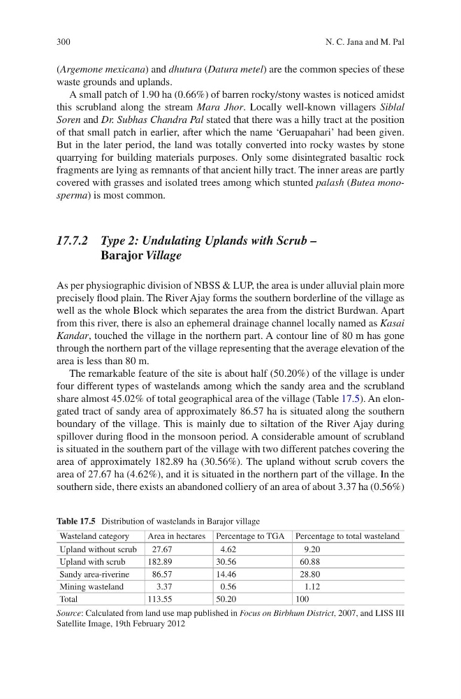
share almost 45.02% of total geographical area of the village (Table 17.5). An elongated tract of sandy area of approximately 86.57 ha is situated along the southern
boundary of the village. This is mainly due to siltation of the River Ajay during
spillover during flood in the monsoon period. A considerable amount of scrubland
is situated in the southern part of the village with two different patches covering the
area of approximately 182.89 ha (30.56%). The upland without scrub covers the
area of 27.67 ha (4.62%), and it is situated in the northern part of the village. In the
southern side, there exists an abandoned colliery of an area of about 3.37 ha (0.56%)
Table 17.5 Distribution of wastelands in Barajor village
Wasteland category
Area in hectares Percentage to TGA Percentage to total wasteland
Upland without scrub
27.67
4.62
9.20
Upland with scrub
182.89
30.56
60.88
Sandy area-riverine
86.57
14.46
28.80
Mining wasteland
3.37
0.56
1.12
Total
113.55
50.20
100
Source: Calculated from land use map published in Focus on Birbhum District, 2007, and LISS III
Satellite Image, 19th February 2012
N. C. Jana and M. Pal
(Argemone mexicana) and dhutura (Datura metel) are the common species of these
waste grounds and uplands.
A small patch of 1.90 ha (0.66%) of barren rocky/stony wastes is noticed amidst
this scrubland along the stream Mara Jhor. Locally well-known villagers Siblal
Soren and Dr. Subhas Chandra Pal stated that there was a hilly tract at the position
of that small patch in earlier, after which the name ‘Geruapahari’ had been given.
But in the later period, the land was totally converted into rocky wastes by stone
quarrying for building materials purposes. Only some disintegrated basaltic rock
fragments are lying as remnants of that ancient hilly tract. The inner areas are partly
covered with grasses and isolated trees among which stunted palash (Butea monosperma) is most common.
17.7.2 Type 2: Undulating Uplands with Scrub –
Barajor Village
As per physiographic division of NBSS & LUP, the area is under alluvial plain more
precisely flood plain. The River Ajay forms the southern borderline of the village as
well as the whole Block which separates the area from the district Burdwan. Apart
from this river, there is also an ephemeral drainage channel locally named as Kasai
Kandar, touched the village in the northern part. A contour line of 80 m has gone
through the northern part of the village representing that the average elevation of the
area is less than 80 m.
The remarkable feature of the site is about half (50.20%) of the village is under
four different types of wastelands among which the sandy area and the scrubland
share almost 45.02% of total geographical area of the village (Table 17.5). An elongated tract of sandy area of approximately 86.57 ha is situated along the southern
boundary of the village. This is mainly due to siltation of the River Ajay during
spillover during flood in the monsoon period. A considerable amount of scrubland
is situated in the southern part of the village with two different patches covering the
area of approximately 182.89 ha (30.56%). The upland without scrub covers the
area of 27.67 ha (4.62%), and it is situated in the northern part of the village. In the
southern side, there exists an abandoned colliery of an area of about 3.37 ha (0.56%)
Table 17.5 Distribution of wastelands in Barajor village
Wasteland category
Area in hectares Percentage to TGA Percentage to total wasteland
Upland without scrub
27.67
4.62
9.20
Upland with scrub
182.89
30.56
60.88
Sandy area-riverine
86.57
14.46
28.80
Mining wasteland
3.37
0.56
1.12
Total
113.55
50.20
100
Source: Calculated from land use map published in Focus on Birbhum District, 2007, and LISS III
Satellite Image, 19th February 2012
N. C. Jana and M. Pal