

238
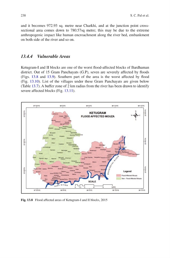
Fig. 13.8 Flood affected areas of Ketugram-I and II blocks, 2015
and it becomes 972.93 sq. metre near Charkhi, and at the junction point crosssectional area comes down to 780.57sq metre; this may be due to the extreme
anthropogenic impact like human encroachment along the river bed, embankment
on both side of the river and so on.
13.4.4 Vulnerable Areas
Ketugram-I and II blocks are one of the worst flood-affected blocks of Bardhaman
district. Out of 15 Gram Panchayats (G.P), seven are severely affected by floods
(Figs. 13.8 and 13.9). Southern part of the area is the worst affected by flood
(Fig. 13.10). List of the villages under these Gram Panchayats are given below
(Table 13.7). A buffer zone of 2 km radius from the river has been drawn to identify
severe affected blocks (Fig. 13.11).
S. C. Pal et al.
Fig. 13.8 Flood affected areas of Ketugram-I and II blocks, 2015
and it becomes 972.93 sq. metre near Charkhi, and at the junction point crosssectional area comes down to 780.57sq metre; this may be due to the extreme
anthropogenic impact like human encroachment along the river bed, embankment
on both side of the river and so on.
13.4.4 Vulnerable Areas
Ketugram-I and II blocks are one of the worst flood-affected blocks of Bardhaman
district. Out of 15 Gram Panchayats (G.P), seven are severely affected by floods
(Figs. 13.8 and 13.9). Southern part of the area is the worst affected by flood
(Fig. 13.10). List of the villages under these Gram Panchayats are given below
(Table 13.7). A buffer zone of 2 km radius from the river has been drawn to identify
severe affected blocks (Fig. 13.11).
S. C. Pal et al.