

are areas composed of rounded and sub-rounded boulders
from intense water erosion. Closed (endorheic) basins were
hollowed out by rapidly flowing water and have no apparent
outlet. Dry cataracts are former waterfalls; plunge pools are
basins carved into bedrock at the bottom of these waterfalls.
Potholes are deep circular holes in bedrock formed by water
erosion by the rotation of stones in an eddy.
Depositional evidence of former shorelines include beach
ridges, raised beaches, sand spits, tombolos, drowned forests, and varved lakes. Beach ridges are ridges running
parallel to a shoreline that are formed by wave action. Raised
beaches are former shorelines that occur near or above the
modern lake or ocean level due to isostatic rebound. Sand
spits are narrow point of sandy land projecting into the sea or
a lake. Tombolos are bars joining an island to a mainland.
Drowned forests result from changes in lake level due to
flooding. Varves (rhythmites) are pairs of annual layers of
silt and clay of contrasting color that represent the deposit of
a single year (summer and winter) in a lake.
One of the problems in interpreting past shorelines of the
Great Lakes region is the manner in which the data were
recorded. Some investigators record elevations of wave-cut
bluffs, which result from storm-wave maximum heights;
others record wave-cut benches, and still others report the
surfaces or base or base of wave-built terraces. The distance
from the top of wave-cut bluff and the base of the wave-built
terrace may be 100 ft. (30 m) or more. Schaetzl et al. (2002)
recommend that former shorelines be measured using a
differential global positioning system (DGPS) at the surface
of the boulder lag at the base of the wave-cut bluff.
The timing of the changes in former levels of the Great
Lakes is based on hundreds of dates collected from former
lake terraces. From these dates, a chronology of the Great
Lakes basin can be established (Table 2.1). From the work
of Hough (1958), modified by Prest (1970), and depicted by
Clark et al. (2012), the oldest lakes identified in the Great
Lakes basin existed 13.8 kyr BP and include Glacial Lake
Oshkosh in front of the Green Bay lobe, Glacial Lake
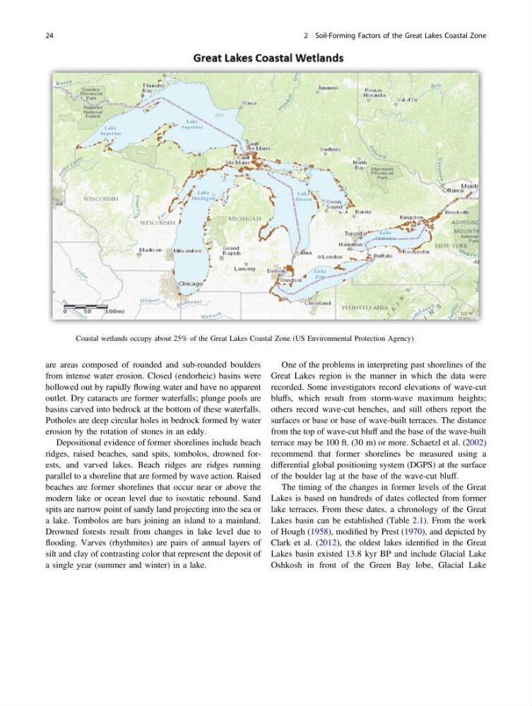
Fig. 2.7 Coastal wetlands occupy about 25% of the Great Lakes Coastal Zone (US Environmental Protection Agency)
24
2 Soil-Forming Factors of the Great Lakes Coastal Zone
from intense water erosion. Closed (endorheic) basins were
hollowed out by rapidly flowing water and have no apparent
outlet. Dry cataracts are former waterfalls; plunge pools are
basins carved into bedrock at the bottom of these waterfalls.
Potholes are deep circular holes in bedrock formed by water
erosion by the rotation of stones in an eddy.
Depositional evidence of former shorelines include beach
ridges, raised beaches, sand spits, tombolos, drowned forests, and varved lakes. Beach ridges are ridges running
parallel to a shoreline that are formed by wave action. Raised
beaches are former shorelines that occur near or above the
modern lake or ocean level due to isostatic rebound. Sand
spits are narrow point of sandy land projecting into the sea or
a lake. Tombolos are bars joining an island to a mainland.
Drowned forests result from changes in lake level due to
flooding. Varves (rhythmites) are pairs of annual layers of
silt and clay of contrasting color that represent the deposit of
a single year (summer and winter) in a lake.
One of the problems in interpreting past shorelines of the
Great Lakes region is the manner in which the data were
recorded. Some investigators record elevations of wave-cut
bluffs, which result from storm-wave maximum heights;
others record wave-cut benches, and still others report the
surfaces or base or base of wave-built terraces. The distance
from the top of wave-cut bluff and the base of the wave-built
terrace may be 100 ft. (30 m) or more. Schaetzl et al. (2002)
recommend that former shorelines be measured using a
differential global positioning system (DGPS) at the surface
of the boulder lag at the base of the wave-cut bluff.
The timing of the changes in former levels of the Great
Lakes is based on hundreds of dates collected from former
lake terraces. From these dates, a chronology of the Great
Lakes basin can be established (Table 2.1). From the work
of Hough (1958), modified by Prest (1970), and depicted by
Clark et al. (2012), the oldest lakes identified in the Great
Lakes basin existed 13.8 kyr BP and include Glacial Lake
Oshkosh in front of the Green Bay lobe, Glacial Lake
Fig. 2.7 Coastal wetlands occupy about 25% of the Great Lakes Coastal Zone (US Environmental Protection Agency)
24
2 Soil-Forming Factors of the Great Lakes Coastal Zone