

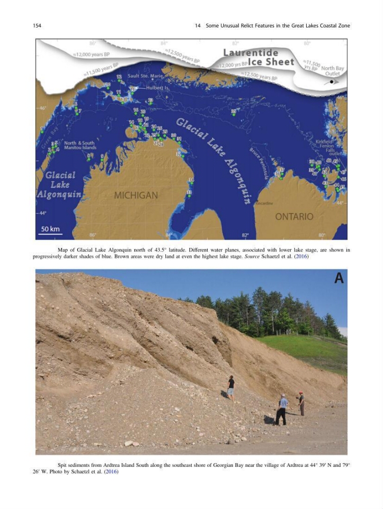
Fig. 14.6 Map of Glacial Lake Algonquin north of 43.5° latitude. Different water planes, associated with lower lake stage, are shown in
progressively darker shades of blue. Brown areas were dry land at even the highest lake stage. Source Schaetzl et al. (2016)
Fig. 14.7 Spit sediments from Ardtrea Island South along the southeast shore of Georgian Bay near the village of Ardtrea at 44° 39′ N and 79°
26′ W. Photo by Schaetzl et al. (2016)
154
14 Some Unusual Relict Features in the Great Lakes Coastal Zone
progressively darker shades of blue. Brown areas were dry land at even the highest lake stage. Source Schaetzl et al. (2016)
Fig. 14.7 Spit sediments from Ardtrea Island South along the southeast shore of Georgian Bay near the village of Ardtrea at 44° 39′ N and 79°
26′ W. Photo by Schaetzl et al. (2016)
154
14 Some Unusual Relict Features in the Great Lakes Coastal Zone