

190
Now that’s something to brag about! I find that as I travel around the country giving
talks about the changing south Florida ecosystem, most people have an image of
Florida in their mind, but rarely does it include mangroves. For many, it’s Disney
World and the other tourist attractions centered around Orlando. For others it’s the
over 8000 miles (13,000 km) of shoreline and the beautiful sandy beaches or the
turquoise waters of the Florida Keys. For some, it’s the international vibe of Miami.
These are just some of the reasons that tourists flock to Florida – over 125 million
in 2018 alone. The sub-tropical climate and proximity to water are also the reasons
many people are moving to Florida. The state has seen a 13.3% increase in population since 2010, with over 21 million people calling Florida home. It is now the third
most populous state in the United States, after California and Texas. But where are
all these people going and how does that impact the natural resources and
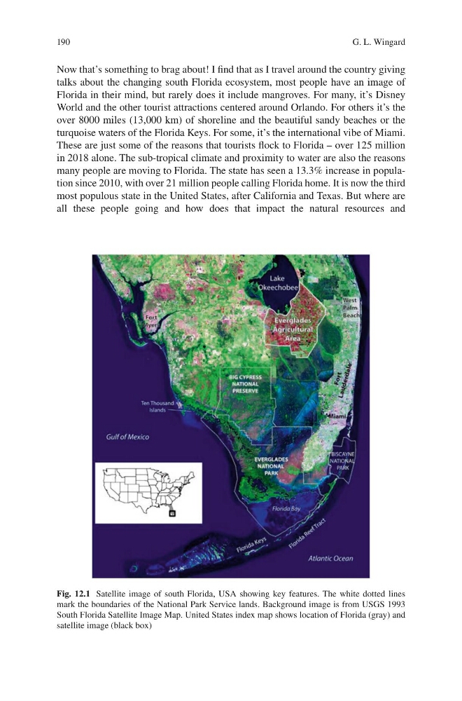
Fig. 12.1 Satellite image of south Florida, USA showing key features. The white dotted lines
mark the boundaries of the National Park Service lands. Background image is from USGS 1993
South Florida Satellite Image Map. United States index map shows location of Florida (gray) and
satellite image (black box)
G. L. Wingard
Now that’s something to brag about! I find that as I travel around the country giving
talks about the changing south Florida ecosystem, most people have an image of
Florida in their mind, but rarely does it include mangroves. For many, it’s Disney
World and the other tourist attractions centered around Orlando. For others it’s the
over 8000 miles (13,000 km) of shoreline and the beautiful sandy beaches or the
turquoise waters of the Florida Keys. For some, it’s the international vibe of Miami.
These are just some of the reasons that tourists flock to Florida – over 125 million
in 2018 alone. The sub-tropical climate and proximity to water are also the reasons
many people are moving to Florida. The state has seen a 13.3% increase in population since 2010, with over 21 million people calling Florida home. It is now the third
most populous state in the United States, after California and Texas. But where are
all these people going and how does that impact the natural resources and
Fig. 12.1 Satellite image of south Florida, USA showing key features. The white dotted lines
mark the boundaries of the National Park Service lands. Background image is from USGS 1993
South Florida Satellite Image Map. United States index map shows location of Florida (gray) and
satellite image (black box)
G. L. Wingard