

157
potentially meters (Fig. 10.4). In two of these past earthquake deposits the abrupt
change from peat to silt was bisected by a grey sand layer…evidence that previous
megathrust earthquakes also produced giant tsunamis that inundated much of the
marsh surface and extended into the upland forests. If you were living in low-lying
areas near the coast, the earthquake shaking would precede the tsunami waves by
maybe 10–20 min. It is more than likely that some of North America’s First Peoples
may have experienced earthquakes and tsunami after crossing the land bridge from
Siberia and migrating south down the west coast of North America.
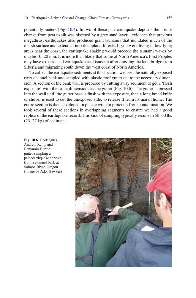
To collect the earthquake sediments at this location we used the naturally exposed
river channel bank and sampled with plastic roof gutter cut to the necessary dimension. A section of the bank wall is prepared by cutting away sediment to get a ‘fresh
exposure’ with the same dimensions as the gutter (Fig. 10.6). The gutter is pressed
into the wall until the gutter base is flush with the exposure, then a long bread knife
or shovel is used to cut the unexposed side, to release it from its marsh home. The
entire section is then enveloped in plastic wrap to protect it from contamination. We
took several of these sections in overlapping segments to ensure we had a good
replica of the earthquake record. This kind of sampling typically results in 50–60 lbs
(23–27 kg) of sediment.
Fig. 10.6 Colleagues,
Andrew Kemp and
Benjamin Horton,
gutter-sampling a
paleoearthquake deposit
from a channel bank at
Salmon River, Oregon.
(Image by A.D. Hawkes)
10 Earthquake-Driven Coastal Change: Ghost Forests, Graveyards…
potentially meters (Fig. 10.4). In two of these past earthquake deposits the abrupt
change from peat to silt was bisected by a grey sand layer…evidence that previous
megathrust earthquakes also produced giant tsunamis that inundated much of the
marsh surface and extended into the upland forests. If you were living in low-lying
areas near the coast, the earthquake shaking would precede the tsunami waves by
maybe 10–20 min. It is more than likely that some of North America’s First Peoples
may have experienced earthquakes and tsunami after crossing the land bridge from
Siberia and migrating south down the west coast of North America.
To collect the earthquake sediments at this location we used the naturally exposed
river channel bank and sampled with plastic roof gutter cut to the necessary dimension. A section of the bank wall is prepared by cutting away sediment to get a ‘fresh
exposure’ with the same dimensions as the gutter (Fig. 10.6). The gutter is pressed
into the wall until the gutter base is flush with the exposure, then a long bread knife
or shovel is used to cut the unexposed side, to release it from its marsh home. The
entire section is then enveloped in plastic wrap to protect it from contamination. We
took several of these sections in overlapping segments to ensure we had a good
replica of the earthquake record. This kind of sampling typically results in 50–60 lbs
(23–27 kg) of sediment.
Fig. 10.6 Colleagues,
Andrew Kemp and
Benjamin Horton,
gutter-sampling a
paleoearthquake deposit
from a channel bank at
Salmon River, Oregon.
(Image by A.D. Hawkes)
10 Earthquake-Driven Coastal Change: Ghost Forests, Graveyards…