

104
investigations (note: with better safety protocols!). One exciting application of
drones is using them to create 3D models of the landscape to measure volume losses
in beaches and dunes. To create such a digital elevation model (DEM) requires powerful computer hardware and software. In a process known as Structure from
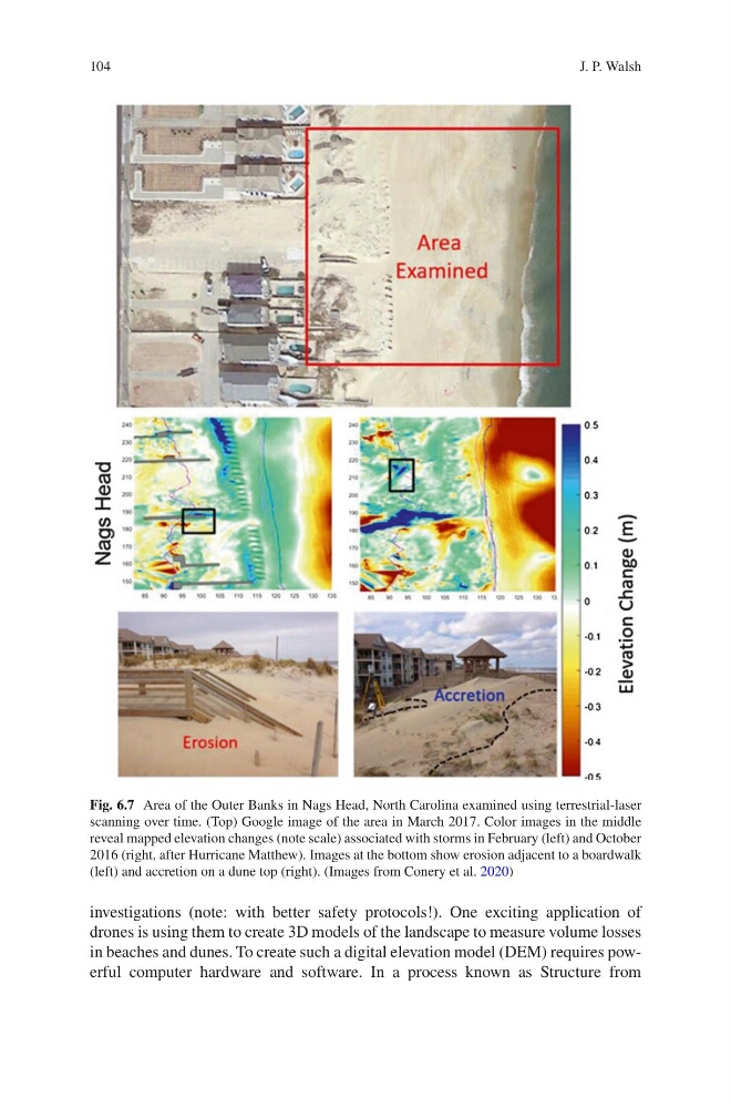
Fig. 6.7 Area of the Outer Banks in Nags Head, North Carolina examined using terrestrial-laser
scanning over time. (Top) Google image of the area in March 2017. Color images in the middle
reveal mapped elevation changes (note scale) associated with storms in February (left) and October
2016 (right, after Hurricane Matthew). Images at the bottom show erosion adjacent to a boardwalk
(left) and accretion on a dune top (right). (Images from Conery et al. 2020)
J. P. Walsh
investigations (note: with better safety protocols!). One exciting application of
drones is using them to create 3D models of the landscape to measure volume losses
in beaches and dunes. To create such a digital elevation model (DEM) requires powerful computer hardware and software. In a process known as Structure from
Fig. 6.7 Area of the Outer Banks in Nags Head, North Carolina examined using terrestrial-laser
scanning over time. (Top) Google image of the area in March 2017. Color images in the middle
reveal mapped elevation changes (note scale) associated with storms in February (left) and October
2016 (right, after Hurricane Matthew). Images at the bottom show erosion adjacent to a boardwalk
(left) and accretion on a dune top (right). (Images from Conery et al. 2020)
J. P. Walsh