

studies have shown that the broad wavelength spectral data available on current
satellites do not permit discrimination between chlorophyll and suspended sediments
when suspended sediment concentrations are high due to the spectral dominance of
the spectral signal from suspended sediment [36]. Recent studies have concentrated
on the relationship between chlorophyll-a and the narrow band spectral details at the
red edge of the visible range of the electromagnetic spectrum.
4.2 Modeling
Accurate modeling requires the estimation of spatial and temporal distribution of
water resources parameters. Remote sensing and GIS are efficient tools used to
extract and integrate the relevant spatial and non-spatial data needed for groundwater, hydrologic, and hydraulic modeling.
4.2.1 Groundwater Modeling
GIS have been increasingly used in geohydrologic investigation as they provide a
variety of spatial analysis tools for groundwater modeling. GIS can be linked to
groundwater models such as MODFLOW to simulate groundwater dynamics in an
aquifer. Groundwater database can be imported into GIS environment to analyze
hydraulic conductivity and transmissivity of the aquifer by raster overlay techniques.
By using the GIS raster database, an effective and improved pre- and post-processing
can be obtained.
Geological methods, involving interpretation of geologic data and field reconnaissance, represent an important first step in any groundwater investigation. Remote
sensing has become a valuable tool for detecting and mapping surface features
related to potential groundwater accumulation. The satellite imageries are used to
map lithologies, lineament, soils, vegetation, and structure. When these maps are
combined with meteorological information and local hydrologic data, groundwater
potential can be assessed and prospective targets ranked according to their probable
suitability as aquifers. The various thematic and interpretive surface parameters
derived from remotely sensed data together with subsurface ancillary data derived
from wells can be integrated and analyzed through GIS to predict potential groundwater zones. The groundwater potential zone can be calculated from thematic layers
using a modified form of the DRASTIC model, which is used to assess groundwater
pollution vulnerability by the Environmental Protection Agency of the United States
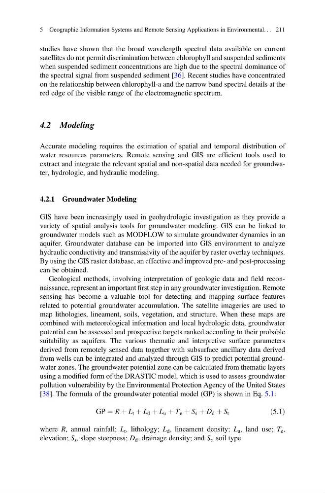
[38]. The formula of the groundwater potential model (GP) is shown in Eq. 5.1:
GP ¼ R þ L t þ L d þ L u þ T e þ S s þ D d þ S t
ð5:1Þ
where R, annual rainfall; L t , lithology; L d , lineament density; L u , land use; T e ,
elevation; S s , slope steepness; D d , drainage density; and S t , soil type.
5 Geographic Information Systems and Remote Sensing Applications in Environmental. . . 211
satellites do not permit discrimination between chlorophyll and suspended sediments
when suspended sediment concentrations are high due to the spectral dominance of
the spectral signal from suspended sediment [36]. Recent studies have concentrated
on the relationship between chlorophyll-a and the narrow band spectral details at the
red edge of the visible range of the electromagnetic spectrum.
4.2 Modeling
Accurate modeling requires the estimation of spatial and temporal distribution of
water resources parameters. Remote sensing and GIS are efficient tools used to
extract and integrate the relevant spatial and non-spatial data needed for groundwater, hydrologic, and hydraulic modeling.
4.2.1 Groundwater Modeling
GIS have been increasingly used in geohydrologic investigation as they provide a
variety of spatial analysis tools for groundwater modeling. GIS can be linked to
groundwater models such as MODFLOW to simulate groundwater dynamics in an
aquifer. Groundwater database can be imported into GIS environment to analyze
hydraulic conductivity and transmissivity of the aquifer by raster overlay techniques.
By using the GIS raster database, an effective and improved pre- and post-processing
can be obtained.
Geological methods, involving interpretation of geologic data and field reconnaissance, represent an important first step in any groundwater investigation. Remote
sensing has become a valuable tool for detecting and mapping surface features
related to potential groundwater accumulation. The satellite imageries are used to
map lithologies, lineament, soils, vegetation, and structure. When these maps are
combined with meteorological information and local hydrologic data, groundwater
potential can be assessed and prospective targets ranked according to their probable
suitability as aquifers. The various thematic and interpretive surface parameters
derived from remotely sensed data together with subsurface ancillary data derived
from wells can be integrated and analyzed through GIS to predict potential groundwater zones. The groundwater potential zone can be calculated from thematic layers
using a modified form of the DRASTIC model, which is used to assess groundwater
pollution vulnerability by the Environmental Protection Agency of the United States
[38]. The formula of the groundwater potential model (GP) is shown in Eq. 5.1:
GP ¼ R þ L t þ L d þ L u þ T e þ S s þ D d þ S t
ð5:1Þ
where R, annual rainfall; L t , lithology; L d , lineament density; L u , land use; T e ,
elevation; S s , slope steepness; D d , drainage density; and S t , soil type.
5 Geographic Information Systems and Remote Sensing Applications in Environmental. . . 211