

detailed analysis. Another source for high-resolution image data for many regions of
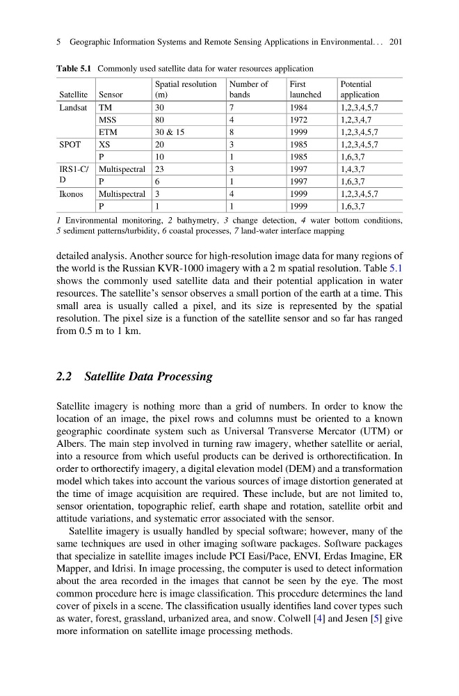
the world is the Russian KVR-1000 imagery with a 2 m spatial resolution. Table 5.1
shows the commonly used satellite data and their potential application in water
resources. The satellite’s sensor observes a small portion of the earth at a time. This
small area is usually called a pixel, and its size is represented by the spatial
resolution. The pixel size is a function of the satellite sensor and so far has ranged
from 0.5 m to 1 km.
2.2 Satellite Data Processing
Satellite imagery is nothing more than a grid of numbers. In order to know the
location of an image, the pixel rows and columns must be oriented to a known
geographic coordinate system such as Universal Transverse Mercator (UTM) or
Albers. The main step involved in turning raw imagery, whether satellite or aerial,
into a resource from which useful products can be derived is orthorectification. In
order to orthorectify imagery, a digital elevation model (DEM) and a transformation
model which takes into account the various sources of image distortion generated at
the time of image acquisition are required. These include, but are not limited to,
sensor orientation, topographic relief, earth shape and rotation, satellite orbit and
attitude variations, and systematic error associated with the sensor.
Satellite imagery is usually handled by special software; however, many of the
same techniques are used in other imaging software packages. Software packages
that specialize in satellite images include PCI Easi/Pace, ENVI, Erdas Imagine, ER
Mapper, and Idrisi. In image processing, the computer is used to detect information
about the area recorded in the images that cannot be seen by the eye. The most
common procedure here is image classification. This procedure determines the land
cover of pixels in a scene. The classification usually identifies land cover types such
as water, forest, grassland, urbanized area, and snow. Colwell [4] and Jesen [5] give
more information on satellite image processing methods.
Table 5.1 Commonly used satellite data for water resources application
Satellite Sensor
Spatial resolution
(m)
Number of
bands
First
launched
Potential
application
Landsat TM
30
7
1984
1,2,3,4,5,7
MSS
80
4
1972
1,2,3,4,7
ETM
30 & 15
8
1999
1,2,3,4,5,7
SPOT
XS
20
3
1985
1,2,3,4,5,7
P
10
1
1985
1,6,3,7
IRS1-C/
D
Multispectral 23
3
1997
1,4,3,7
P
6
1
1997
1,6,3,7
Ikonos
Multispectral 3
4
1999
1,2,3,4,5,7
P
1
1
1999
1,6,3,7
1 Environmental monitoring, 2 bathymetry, 3 change detection, 4 water bottom conditions,
5 sediment patterns/turbidity, 6 coastal processes, 7 land-water interface mapping
5 Geographic Information Systems and Remote Sensing Applications in Environmental. . . 201
the world is the Russian KVR-1000 imagery with a 2 m spatial resolution. Table 5.1
shows the commonly used satellite data and their potential application in water
resources. The satellite’s sensor observes a small portion of the earth at a time. This
small area is usually called a pixel, and its size is represented by the spatial
resolution. The pixel size is a function of the satellite sensor and so far has ranged
from 0.5 m to 1 km.
2.2 Satellite Data Processing
Satellite imagery is nothing more than a grid of numbers. In order to know the
location of an image, the pixel rows and columns must be oriented to a known
geographic coordinate system such as Universal Transverse Mercator (UTM) or
Albers. The main step involved in turning raw imagery, whether satellite or aerial,
into a resource from which useful products can be derived is orthorectification. In
order to orthorectify imagery, a digital elevation model (DEM) and a transformation
model which takes into account the various sources of image distortion generated at
the time of image acquisition are required. These include, but are not limited to,
sensor orientation, topographic relief, earth shape and rotation, satellite orbit and
attitude variations, and systematic error associated with the sensor.
Satellite imagery is usually handled by special software; however, many of the
same techniques are used in other imaging software packages. Software packages
that specialize in satellite images include PCI Easi/Pace, ENVI, Erdas Imagine, ER
Mapper, and Idrisi. In image processing, the computer is used to detect information
about the area recorded in the images that cannot be seen by the eye. The most
common procedure here is image classification. This procedure determines the land
cover of pixels in a scene. The classification usually identifies land cover types such
as water, forest, grassland, urbanized area, and snow. Colwell [4] and Jesen [5] give
more information on satellite image processing methods.
Table 5.1 Commonly used satellite data for water resources application
Satellite Sensor
Spatial resolution
(m)
Number of
bands
First
launched
Potential
application
Landsat TM
30
7
1984
1,2,3,4,5,7
MSS
80
4
1972
1,2,3,4,7
ETM
30 & 15
8
1999
1,2,3,4,5,7
SPOT
XS
20
3
1985
1,2,3,4,5,7
P
10
1
1985
1,6,3,7
IRS1-C/
D
Multispectral 23
3
1997
1,4,3,7
P
6
1
1997
1,6,3,7
Ikonos
Multispectral 3
4
1999
1,2,3,4,5,7
P
1
1
1999
1,6,3,7
1 Environmental monitoring, 2 bathymetry, 3 change detection, 4 water bottom conditions,
5 sediment patterns/turbidity, 6 coastal processes, 7 land-water interface mapping
5 Geographic Information Systems and Remote Sensing Applications in Environmental. . . 201