

wet and dense. The rocks are basically weathered into short and long cylindrical
shapes.
45–53.2 m moderately-weathered limestone: It has clearly-structured host rock
(which is limestone), developed joint fissures and very developed karst fissures,
being grayish white-grayish blue, wet and dense. The rocks are basically weathered
into short and long cylindrical shapes.
The bedrock throughout the borehole is relatively fragile with developed fissures. The roof of the main aquifer of the well is the 49 m water leakage course and
the total depth of the borehole is 53.2 m.
② Groundwater runoff
The groundwater flow direction should be determined first by understanding the
general direction of the area by consulting the relevant units in the area concerned,
including the local departments of water resources, departments of the environment
or geological exploration organizations, and then further identifying the actual
groundwater direction of the study area using relevant techniques in field land
survey.
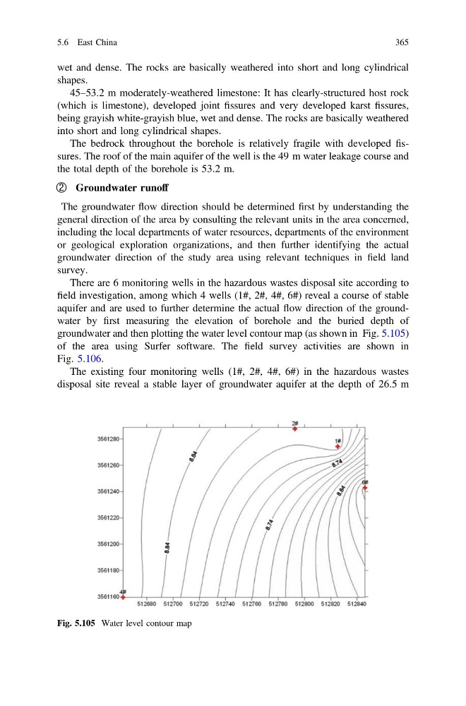
There are 6 monitoring wells in the hazardous wastes disposal site according to
field investigation, among which 4 wells (1#, 2#, 4#, 6#) reveal a course of stable
aquifer and are used to further determine the actual flow direction of the groundwater by first measuring the elevation of borehole and the buried depth of
groundwater and then plotting the water level contour map (as shown in Fig. 5.105)
of the area using Surfer software. The field survey activities are shown in
Fig. 5.106.
The existing four monitoring wells (1#, 2#, 4#, 6#) in the hazardous wastes
disposal site reveal a stable layer of groundwater aquifer at the depth of 26.5 m
Fig. 5.105 Water level contour map
5.6 East China
365
shapes.
45–53.2 m moderately-weathered limestone: It has clearly-structured host rock
(which is limestone), developed joint fissures and very developed karst fissures,
being grayish white-grayish blue, wet and dense. The rocks are basically weathered
into short and long cylindrical shapes.
The bedrock throughout the borehole is relatively fragile with developed fissures. The roof of the main aquifer of the well is the 49 m water leakage course and
the total depth of the borehole is 53.2 m.
② Groundwater runoff
The groundwater flow direction should be determined first by understanding the
general direction of the area by consulting the relevant units in the area concerned,
including the local departments of water resources, departments of the environment
or geological exploration organizations, and then further identifying the actual
groundwater direction of the study area using relevant techniques in field land
survey.
There are 6 monitoring wells in the hazardous wastes disposal site according to
field investigation, among which 4 wells (1#, 2#, 4#, 6#) reveal a course of stable
aquifer and are used to further determine the actual flow direction of the groundwater by first measuring the elevation of borehole and the buried depth of
groundwater and then plotting the water level contour map (as shown in Fig. 5.105)
of the area using Surfer software. The field survey activities are shown in
Fig. 5.106.
The existing four monitoring wells (1#, 2#, 4#, 6#) in the hazardous wastes
disposal site reveal a stable layer of groundwater aquifer at the depth of 26.5 m
Fig. 5.105 Water level contour map
5.6 East China
365