

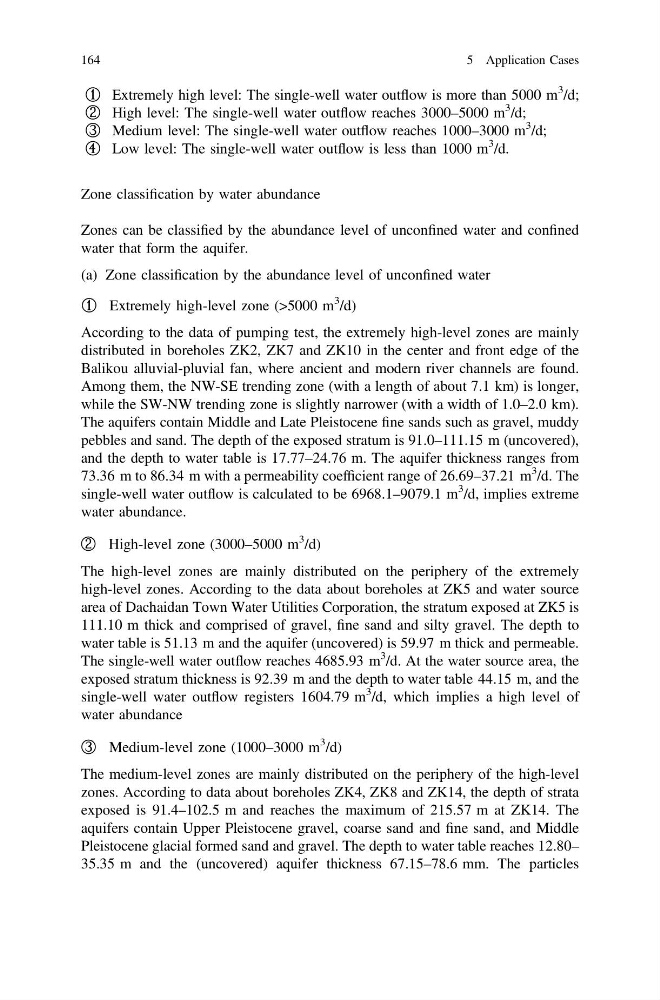
① Extremely high level: The single-well water outflow is more than 5000 m
3 /d;
② High level: The single-well water outflow reaches 3000–5000 m
3 /d;
③ Medium level: The single-well water outflow reaches 1000–3000 m
3 /d;
④ Low level: The single-well water outflow is less than 1000 m
3 /d.
Zone classification by water abundance
Zones can be classified by the abundance level of unconfined water and confined
water that form the aquifer.
(a) Zone classification by the abundance level of unconfined water
① Extremely high-level zone (>5000 m
3 /d)
According to the data of pumping test, the extremely high-level zones are mainly
distributed in boreholes ZK2, ZK7 and ZK10 in the center and front edge of the
Balikou alluvial-pluvial fan, where ancient and modern river channels are found.
Among them, the NW-SE trending zone (with a length of about 7.1 km) is longer,
while the SW-NW trending zone is slightly narrower (with a width of 1.0–2.0 km).
The aquifers contain Middle and Late Pleistocene fine sands such as gravel, muddy
pebbles and sand. The depth of the exposed stratum is 91.0–111.15 m (uncovered),
and the depth to water table is 17.77–24.76 m. The aquifer thickness ranges from
73.36 m to 86.34 m with a permeability coefficient range of 26.69–37.21 m
3 /d. The
single-well water outflow is calculated to be 6968.1–9079.1 m
3 /d, implies extreme
water abundance.
② High-level zone (3000–5000 m
3
/d)
The high-level zones are mainly distributed on the periphery of the extremely
high-level zones. According to the data about boreholes at ZK5 and water source
area of Dachaidan Town Water Utilities Corporation, the stratum exposed at ZK5 is
111.10 m thick and comprised of gravel, fine sand and silty gravel. The depth to
water table is 51.13 m and the aquifer (uncovered) is 59.97 m thick and permeable.
The single-well water outflow reaches 4685.93 m
3 /d. At the water source area, the
exposed stratum thickness is 92.39 m and the depth to water table 44.15 m, and the
single-well water outflow registers 1604.79 m
3 /d, which implies a high level of
water abundance
③ Medium-level zone (1000–3000 m
3 /d)
The medium-level zones are mainly distributed on the periphery of the high-level
zones. According to data about boreholes ZK4, ZK8 and ZK14, the depth of strata
exposed is 91.4–102.5 m and reaches the maximum of 215.57 m at ZK14. The
aquifers contain Upper Pleistocene gravel, coarse sand and fine sand, and Middle
Pleistocene glacial formed sand and gravel. The depth to water table reaches 12.80–
35.35 m and the (uncovered) aquifer thickness 67.15–78.6 mm. The particles
164
5 Application Cases
3 /d;
② High level: The single-well water outflow reaches 3000–5000 m
3 /d;
③ Medium level: The single-well water outflow reaches 1000–3000 m
3 /d;
④ Low level: The single-well water outflow is less than 1000 m
3 /d.
Zone classification by water abundance
Zones can be classified by the abundance level of unconfined water and confined
water that form the aquifer.
(a) Zone classification by the abundance level of unconfined water
① Extremely high-level zone (>5000 m
3 /d)
According to the data of pumping test, the extremely high-level zones are mainly
distributed in boreholes ZK2, ZK7 and ZK10 in the center and front edge of the
Balikou alluvial-pluvial fan, where ancient and modern river channels are found.
Among them, the NW-SE trending zone (with a length of about 7.1 km) is longer,
while the SW-NW trending zone is slightly narrower (with a width of 1.0–2.0 km).
The aquifers contain Middle and Late Pleistocene fine sands such as gravel, muddy
pebbles and sand. The depth of the exposed stratum is 91.0–111.15 m (uncovered),
and the depth to water table is 17.77–24.76 m. The aquifer thickness ranges from
73.36 m to 86.34 m with a permeability coefficient range of 26.69–37.21 m
3 /d. The
single-well water outflow is calculated to be 6968.1–9079.1 m
3 /d, implies extreme
water abundance.
② High-level zone (3000–5000 m
3
/d)
The high-level zones are mainly distributed on the periphery of the extremely
high-level zones. According to the data about boreholes at ZK5 and water source
area of Dachaidan Town Water Utilities Corporation, the stratum exposed at ZK5 is
111.10 m thick and comprised of gravel, fine sand and silty gravel. The depth to
water table is 51.13 m and the aquifer (uncovered) is 59.97 m thick and permeable.
The single-well water outflow reaches 4685.93 m
3 /d. At the water source area, the
exposed stratum thickness is 92.39 m and the depth to water table 44.15 m, and the
single-well water outflow registers 1604.79 m
3 /d, which implies a high level of
water abundance
③ Medium-level zone (1000–3000 m
3 /d)
The medium-level zones are mainly distributed on the periphery of the high-level
zones. According to data about boreholes ZK4, ZK8 and ZK14, the depth of strata
exposed is 91.4–102.5 m and reaches the maximum of 215.57 m at ZK14. The
aquifers contain Upper Pleistocene gravel, coarse sand and fine sand, and Middle
Pleistocene glacial formed sand and gravel. The depth to water table reaches 12.80–
35.35 m and the (uncovered) aquifer thickness 67.15–78.6 mm. The particles
164
5 Application Cases