

before finally flowing into the Bay of Bengal. The rain gauge station for the basin is
located at Trichy Airport.
Methodology Adopted for the Study
The methodology adopted for the present study is explained next.
Data Collection and Processing
The spatial and temporal data required for the study are satellite images and rainfall
data. The satellite images of 30 m resolution Landsat ETM 7+ were collected from
the USGS earth explorer website (https://earthexplorer.usgs.gov/) for the years
1986–2016 at 10-year intervals for LULC analysis. The soil map was acquired
from the Food Agricultural Organization harmonized world soil database (http://
www.fao.org/soils-portal/harmonized-world-soil-database-v12/en/.). The DEM data
are downloaded from ALOS World 3D, a 30 m resolution digital surface model
(DSM) constructed by the Japan Aerospace Exploration Agency used in HEC-Geo
HMS for watershed delineation and subbasin development. The daily rainfall data
are collected from the state surface and groundwater data center, Chennai, from 1977
to 2016.
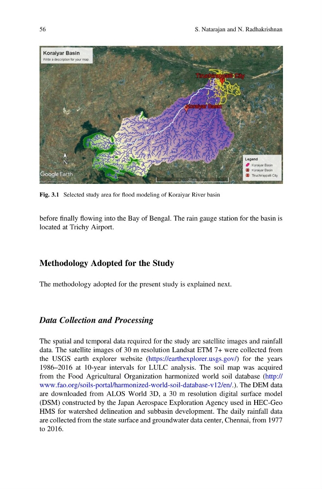
Fig. 3.1 Selected study area for flood modeling of Koraiyar River basin
56
S. Natarajan and N. Radhakrishnan
located at Trichy Airport.
Methodology Adopted for the Study
The methodology adopted for the present study is explained next.
Data Collection and Processing
The spatial and temporal data required for the study are satellite images and rainfall
data. The satellite images of 30 m resolution Landsat ETM 7+ were collected from
the USGS earth explorer website (https://earthexplorer.usgs.gov/) for the years
1986–2016 at 10-year intervals for LULC analysis. The soil map was acquired
from the Food Agricultural Organization harmonized world soil database (http://
www.fao.org/soils-portal/harmonized-world-soil-database-v12/en/.). The DEM data
are downloaded from ALOS World 3D, a 30 m resolution digital surface model
(DSM) constructed by the Japan Aerospace Exploration Agency used in HEC-Geo
HMS for watershed delineation and subbasin development. The daily rainfall data
are collected from the state surface and groundwater data center, Chennai, from 1977
to 2016.
Fig. 3.1 Selected study area for flood modeling of Koraiyar River basin
56
S. Natarajan and N. Radhakrishnan