

648
G. T. Rodrigues and E. N. de Moura
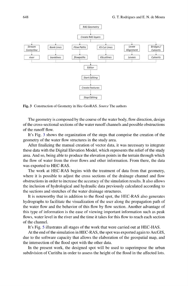
Fig. 3 Construction of Geometry in Hec-GeoRAS. Source The authors
The geometry is composed by the course of the water body, flow direction, design
of the cross-sectional sections of the water runoff channels and possible obstructions
of the runoff flow.
It’s Fig. 3 shows the organization of the steps that comprise the creation of the
geometry of the water flow structures in the study area.
After finalizing the manual creation of vector data, it was necessary to integrate
these data with the Digital Elevation Model, which represents the relief of the study
area. And so, being able to produce the elevation points in the terrain through which
the flow of water from the river flows and other information. From there, the data
was exported to HEC-RAS.
The work at HEC-RAS begins with the treatment of data from that geometry,
where it is possible to adjust the cross sections of the drainage channel and flow
obstructions in order to increase the accuracy of the simulation results. It also allows
the inclusion of hydrological and hydraulic data previously calculated according to
the sections and stretches of the water drainage structures.
It is noteworthy that in addition to the flood spot, the HEC-RAS also generates
hydrographs to facilitate the visualization of the user along the propagation path of
the water flow and the behavior of this flow by flow section. Another advantage of
this type of information is the ease of viewing important information such as peak
flows, water level in the river and the time it takes for this flow to reach each section
of the channel.
It’s Fig. 5 illustrates all stages of the work that were carried out at HEC-HAS.
At the end of the simulation in HEC-RAS, the spot was exported again to ArcGIS,
due to the software capacity that allows the elaboration of the geospatial map, and
the intersection of the flood spot with the other data.
In the present work, the designed spot will be used to superimpose the urban
subdivision of Curitiba in order to assess the height of the flood in the affected lots.