

162
D. Absalon et al.
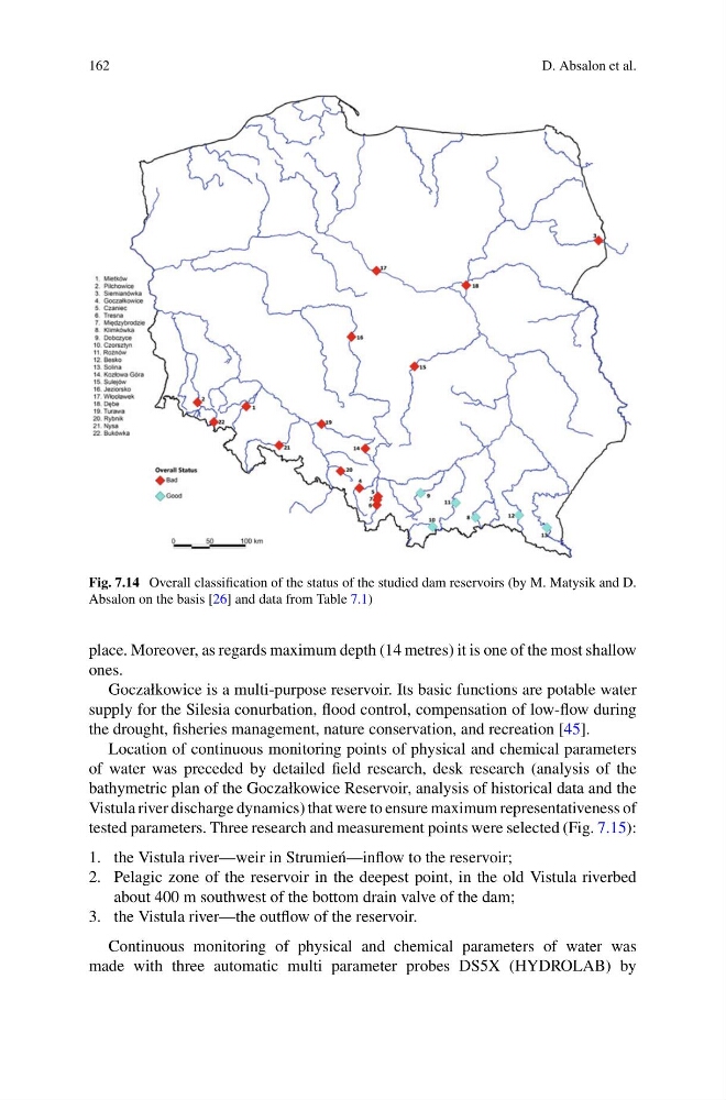
Fig. 7.14 Overall classification of the status of the studied dam reservoirs (by M. Matysik and D.
Absalon on the basis [26] and data from Table 7.1)
place. Moreover, as regards maximum depth (14 metres) it is one of the most shallow
ones.
Goczałkowice is a multi-purpose reservoir. Its basic functions are potable water
supply for the Silesia conurbation, flood control, compensation of low-flow during
the drought, fisheries management, nature conservation, and recreation [45].
Location of continuous monitoring points of physical and chemical parameters
of water was preceded by detailed field research, desk research (analysis of the
bathymetric plan of the Goczałkowice Reservoir, analysis of historical data and the
Vistula river discharge dynamics) that were to ensure maximum representativeness of
tested parameters. Three research and measurement points were selected (Fig. 7.15):
1. the Vistula river—weir in Strumie´ n—inflow to the reservoir;
2. Pelagic zone of the reservoir in the deepest point, in the old Vistula riverbed
about 400 m southwest of the bottom drain valve of the dam;
3. the Vistula river—the outflow of the reservoir.
Continuous monitoring of physical and chemical parameters of water was
made with three automatic multi parameter probes DS5X (HYDROLAB) by
D. Absalon et al.
Fig. 7.14 Overall classification of the status of the studied dam reservoirs (by M. Matysik and D.
Absalon on the basis [26] and data from Table 7.1)
place. Moreover, as regards maximum depth (14 metres) it is one of the most shallow
ones.
Goczałkowice is a multi-purpose reservoir. Its basic functions are potable water
supply for the Silesia conurbation, flood control, compensation of low-flow during
the drought, fisheries management, nature conservation, and recreation [45].
Location of continuous monitoring points of physical and chemical parameters
of water was preceded by detailed field research, desk research (analysis of the
bathymetric plan of the Goczałkowice Reservoir, analysis of historical data and the
Vistula river discharge dynamics) that were to ensure maximum representativeness of
tested parameters. Three research and measurement points were selected (Fig. 7.15):
1. the Vistula river—weir in Strumie´ n—inflow to the reservoir;
2. Pelagic zone of the reservoir in the deepest point, in the old Vistula riverbed
about 400 m southwest of the bottom drain valve of the dam;
3. the Vistula river—the outflow of the reservoir.
Continuous monitoring of physical and chemical parameters of water was
made with three automatic multi parameter probes DS5X (HYDROLAB) by