

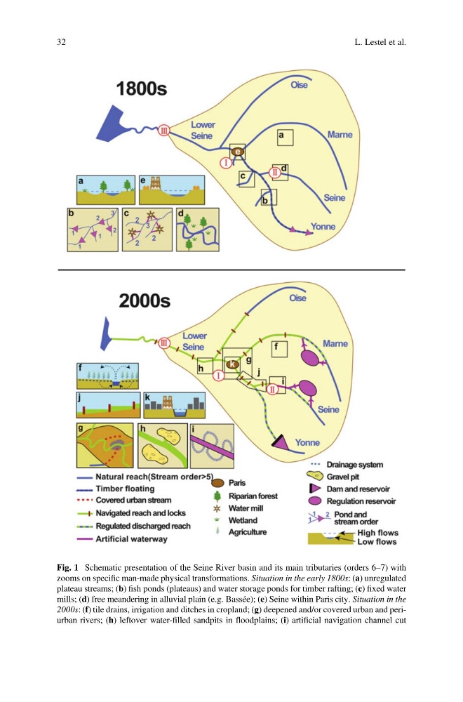
Fig. 1 Schematic presentation of the Seine River basin and its main tributaries (orders 6–7) with
zooms on specific man-made physical transformations. Situation in the early 1800s: (a) unregulated
plateau streams; (b) fish ponds (plateaus) and water storage ponds for timber rafting; (c) fixed water
mills; (d) free meandering in alluvial plain (e.g. Bassée); (e) Seine within Paris city. Situation in the
2000s: (f) tile drains, irrigation and ditches in cropland; (g) deepened and/or covered urban and periurban rivers; (h) leftover water-filled sandpits in floodplains; (i) artificial navigation channel cut
32
L. Lestel et al.
zooms on specific man-made physical transformations. Situation in the early 1800s: (a) unregulated
plateau streams; (b) fish ponds (plateaus) and water storage ponds for timber rafting; (c) fixed water
mills; (d) free meandering in alluvial plain (e.g. Bassée); (e) Seine within Paris city. Situation in the
2000s: (f) tile drains, irrigation and ditches in cropland; (g) deepened and/or covered urban and periurban rivers; (h) leftover water-filled sandpits in floodplains; (i) artificial navigation channel cut
32
L. Lestel et al.