

178
have substantial roles to induce sedimentation in the vulnerable coastal regions. The
mean annual rates of sediment accretion in 24 stations of Indian Sundarbans
(considering a time span of 5 years; 2010–2015) are highlighted in Table 6.7 and
Fig. 6.20.
Views of the potential of mangroves in the process of sedimentation and holding
the soil particles in the Indian Sundarbans are highlighted in Figs. 6.21 and 6.22
respectively as ground zero observation.
It is to be noted in this context that massive deposition of sediments can cause
mangrove mortality, presumably by blocking aeration pathways through aerial
roots; as roots collapse and no new roots are produced, soil compression and shallow subsidence lead to elevation losses (Cahoon 2006). This is the reason why the
central sector of Indian Sundarbans, noted for massive siltation have very less mangrove population with stunted growth. Stations 6–10 in Table 6.8 are under central
Indian Sundarbans, where the population density of mangrove seedlings is low due
to mortality caused by siltation and climate change induced sea level rise (Fig. 6.23).
Such areas are highly vulnerable to sea level rise and need regular flushing of brackish water to get rid of the situation. In the present frame work of Indian Sundarbans,
this can be achieved through interlinking of the Hooghly River in the western Indian
Sundarbans with the Matla River in the central sector of the study area.
Sea level rise in any part of the world poses an adverse impact to both biotic and
abiotic resources of the coastal ecosystems. Salt marshes, a vital biotic component
of coastal ecosystem, are one of the most productive in the world and provide many
ecosystem services such as food production, carbon storage, storm protection, and
nursery habitat for commercially important fish species (Barbier et al. 2011).
However, salt marshes can persist in the face of sea level rise through landward
migration and vertical accretion. Landward migration is the lateral movement of
salt marsh plants into upland habitats (Kirwan et al. 2016). However, when sea
walls, steep upland slopes, or other barriers to marsh migration are present, coastal
squeezes occur. When a natural migration of a coastal habitat is prevented by physical barriers coastal aqueeze occurs (Pontee 2013).
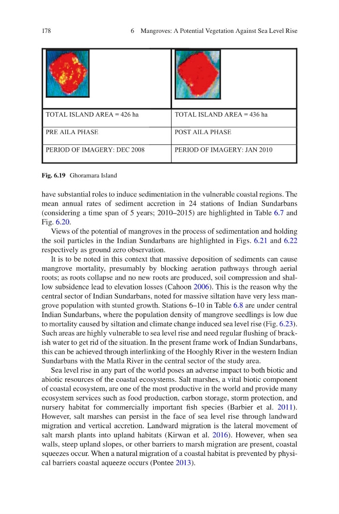
TOTAL ISLAND AREA = 426 ha
TOTAL ISLAND AREA = 436 ha
PRE AILA PHASE
P OST AILA PHASE
PERIOD OF IMAGERY: DEC 2008
PERIOD OF IMAGERY: JAN 2010
Fig. 6.19 Ghoramara Island
6 Mangroves: A Potential Vegetation Against Sea Level Rise
have substantial roles to induce sedimentation in the vulnerable coastal regions. The
mean annual rates of sediment accretion in 24 stations of Indian Sundarbans
(considering a time span of 5 years; 2010–2015) are highlighted in Table 6.7 and
Fig. 6.20.
Views of the potential of mangroves in the process of sedimentation and holding
the soil particles in the Indian Sundarbans are highlighted in Figs. 6.21 and 6.22
respectively as ground zero observation.
It is to be noted in this context that massive deposition of sediments can cause
mangrove mortality, presumably by blocking aeration pathways through aerial
roots; as roots collapse and no new roots are produced, soil compression and shallow subsidence lead to elevation losses (Cahoon 2006). This is the reason why the
central sector of Indian Sundarbans, noted for massive siltation have very less mangrove population with stunted growth. Stations 6–10 in Table 6.8 are under central
Indian Sundarbans, where the population density of mangrove seedlings is low due
to mortality caused by siltation and climate change induced sea level rise (Fig. 6.23).
Such areas are highly vulnerable to sea level rise and need regular flushing of brackish water to get rid of the situation. In the present frame work of Indian Sundarbans,
this can be achieved through interlinking of the Hooghly River in the western Indian
Sundarbans with the Matla River in the central sector of the study area.
Sea level rise in any part of the world poses an adverse impact to both biotic and
abiotic resources of the coastal ecosystems. Salt marshes, a vital biotic component
of coastal ecosystem, are one of the most productive in the world and provide many
ecosystem services such as food production, carbon storage, storm protection, and
nursery habitat for commercially important fish species (Barbier et al. 2011).
However, salt marshes can persist in the face of sea level rise through landward
migration and vertical accretion. Landward migration is the lateral movement of
salt marsh plants into upland habitats (Kirwan et al. 2016). However, when sea
walls, steep upland slopes, or other barriers to marsh migration are present, coastal
squeezes occur. When a natural migration of a coastal habitat is prevented by physical barriers coastal aqueeze occurs (Pontee 2013).
TOTAL ISLAND AREA = 426 ha
TOTAL ISLAND AREA = 436 ha
PRE AILA PHASE
P OST AILA PHASE
PERIOD OF IMAGERY: DEC 2008
PERIOD OF IMAGERY: JAN 2010
Fig. 6.19 Ghoramara Island
6 Mangroves: A Potential Vegetation Against Sea Level Rise