

290
S. Das et al.
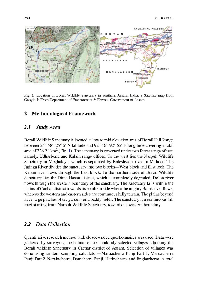
Fig. 1 Location of Borail Wildlife Sanctuary in southern Assam, India: a Satellite map from
Google. b From Department of Environment & Forests, Government of Assam
2 Methodological Framework
2.1 Study Area
Borail Wildlife Sanctuary is located at low to mid elevation area of Borail Hill Range
between 24° 58
–25° 5
N latitude and 92° 46
–92° 52
E longitude covering a total
area of 326.24 km
2 (Fig. 1). The sanctuary is governed under two forest range offices
namely, Udharbond and Kalain range offices. To the west lies the Narpuh Wildlife
Sanctuary in Meghalaya, which is separated by Baleshwori river in Malidor. The
Jatinga River divides the sanctuary into two blocks—West block and East lock. The
Kalain river flows through the East block. To the northern side of Borail Wildlife
Sanctuary lies the Dima Hasao district, which is completely degraded. Doloo river
flows through the western boundary of the sanctuary. The sanctuary falls within the
plains of Cachar district towards its southern side where the mighty Barak river flows,
whereas the western and eastern sides are continuous hilly terrain. The plains beyond
have large patches of tea gardens and paddy fields. The sanctuary is a continuous hill
tract starting from Narpuh Wildlife Sanctuary, towards its western boundary.
2.2 Data Collection
Quantitative research method with closed-ended questionnaires was used. Data were
gathered by surveying the habitat of six randomly selected villages adjoining the
Borail wildlife Sanctuary in Cachar district of Assam. Selection of villages was
done using random sampling calculator—Maruacherra Punji Part 1, Maruacherra
Punji Part 2, Naraincherra, Damcherra Punji, Harincherra, and Jinghacherra. A total
S. Das et al.
Fig. 1 Location of Borail Wildlife Sanctuary in southern Assam, India: a Satellite map from
Google. b From Department of Environment & Forests, Government of Assam
2 Methodological Framework
2.1 Study Area
Borail Wildlife Sanctuary is located at low to mid elevation area of Borail Hill Range
between 24° 58
–25° 5
N latitude and 92° 46
–92° 52
E longitude covering a total
area of 326.24 km
2 (Fig. 1). The sanctuary is governed under two forest range offices
namely, Udharbond and Kalain range offices. To the west lies the Narpuh Wildlife
Sanctuary in Meghalaya, which is separated by Baleshwori river in Malidor. The
Jatinga River divides the sanctuary into two blocks—West block and East lock. The
Kalain river flows through the East block. To the northern side of Borail Wildlife
Sanctuary lies the Dima Hasao district, which is completely degraded. Doloo river
flows through the western boundary of the sanctuary. The sanctuary falls within the
plains of Cachar district towards its southern side where the mighty Barak river flows,
whereas the western and eastern sides are continuous hilly terrain. The plains beyond
have large patches of tea gardens and paddy fields. The sanctuary is a continuous hill
tract starting from Narpuh Wildlife Sanctuary, towards its western boundary.
2.2 Data Collection
Quantitative research method with closed-ended questionnaires was used. Data were
gathered by surveying the habitat of six randomly selected villages adjoining the
Borail wildlife Sanctuary in Cachar district of Assam. Selection of villages was
done using random sampling calculator—Maruacherra Punji Part 1, Maruacherra
Punji Part 2, Naraincherra, Damcherra Punji, Harincherra, and Jinghacherra. A total