

36
margin level. A representative sediment sample was also collected from base of the
Norite Hill (NH), east of the Priyadarshini Lake. The detailed map of the area
around Priyadarshini Lake and Maitri station, from where the samples have been
collected, is shown in Fig. 3 and results are given in Table 1. The points A-B denote
the extreme ends of a line along which the glacial till deposits have been sampled.
The map shows gradual lowering of the height from Point “A” in the South to Point
‘B” in the North which is also, the natural gradient of the ground. This was also the
line of movement of the ice sheet in the LGM as indicated by the glacial features.
Particle size analysis of sediments to infer the provenance and history of the sediment transport (Buckley and Cranston 1991) was also undertaken. According to
1
2
3
4
5
55
50
45
40
35
30
25
20
15
10
Pf
S+Silt+RC
S+RC
CS+RC
VCS+Bld
Legend
5
0
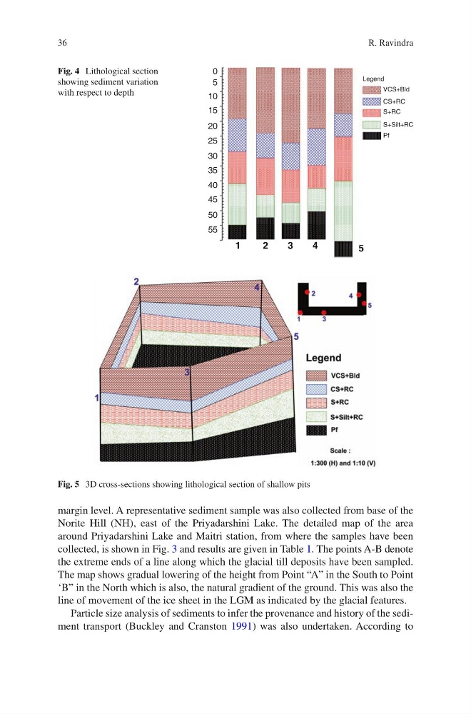
Fig. 4 Lithological section
showing sediment variation
with respect to depth
Fig. 5 3D cross-sections showing lithological section of shallow pits
R. Ravindra
margin level. A representative sediment sample was also collected from base of the
Norite Hill (NH), east of the Priyadarshini Lake. The detailed map of the area
around Priyadarshini Lake and Maitri station, from where the samples have been
collected, is shown in Fig. 3 and results are given in Table 1. The points A-B denote
the extreme ends of a line along which the glacial till deposits have been sampled.
The map shows gradual lowering of the height from Point “A” in the South to Point
‘B” in the North which is also, the natural gradient of the ground. This was also the
line of movement of the ice sheet in the LGM as indicated by the glacial features.
Particle size analysis of sediments to infer the provenance and history of the sediment transport (Buckley and Cranston 1991) was also undertaken. According to
1
2
3
4
5
55
50
45
40
35
30
25
20
15
10
Pf
S+Silt+RC
S+RC
CS+RC
VCS+Bld
Legend
5
0
Fig. 4 Lithological section
showing sediment variation
with respect to depth
Fig. 5 3D cross-sections showing lithological section of shallow pits
R. Ravindra