

11 Monitoring and Management of Water in the Siret River …
381
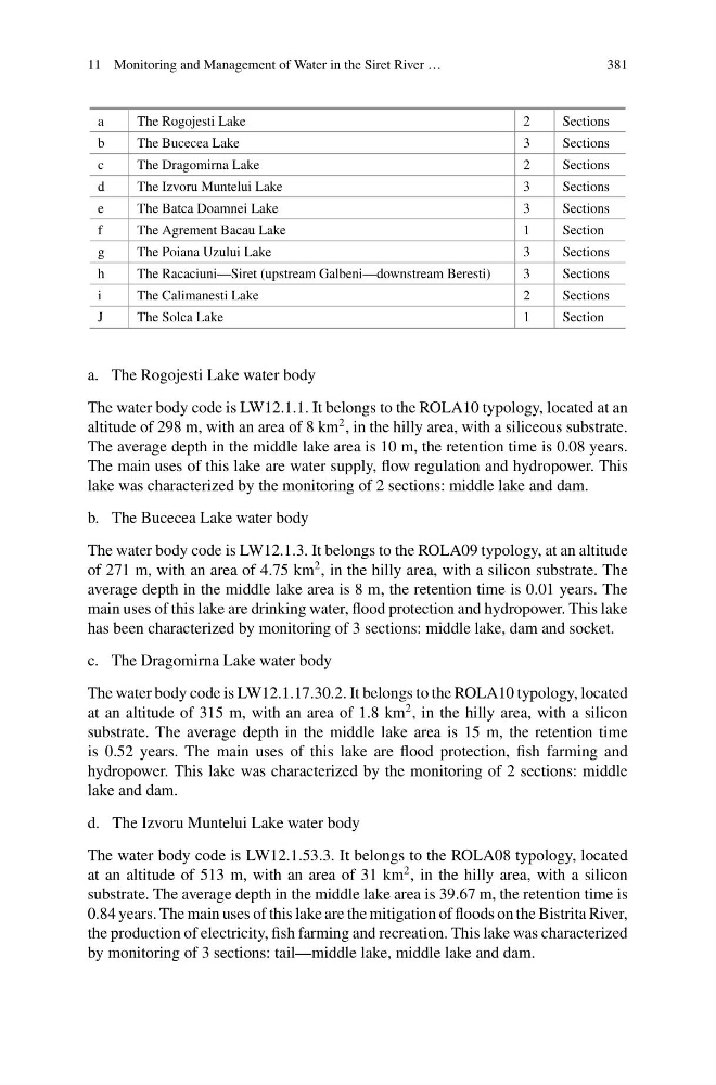
a
The Rogojesti Lake
2
Sections
b
The Bucecea Lake
3
Sections
c
The Dragomirna Lake
2
Sections
d
The Izvoru Muntelui Lake
3
Sections
e
The Batca Doamnei Lake
3
Sections
f
The Agrement Bacau Lake
1
Section
g
The Poiana Uzului Lake
3
Sections
h
The Racaciuni—Siret (upstream Galbeni—downstream Beresti)
3
Sections
i
The Calimanesti Lake
2
Sections
J
The Solca Lake
1
Section
a. The Rogojesti Lake water body
The water body code is LW12.1.1. It belongs to the ROLA10 typology, located at an
altitude of 298 m, with an area of 8 km
2 , in the hilly area, with a siliceous substrate.
The average depth in the middle lake area is 10 m, the retention time is 0.08 years.
The main uses of this lake are water supply, flow regulation and hydropower. This
lake was characterized by the monitoring of 2 sections: middle lake and dam.
b. The Bucecea Lake water body
The water body code is LW12.1.3. It belongs to the ROLA09 typology, at an altitude
of 271 m, with an area of 4.75 km
2 , in the hilly area, with a silicon substrate. The
average depth in the middle lake area is 8 m, the retention time is 0.01 years. The
main uses of this lake are drinking water, flood protection and hydropower. This lake
has been characterized by monitoring of 3 sections: middle lake, dam and socket.
c. The Dragomirna Lake water body
The water body code is LW12.1.17.30.2. It belongs to the ROLA10 typology, located
at an altitude of 315 m, with an area of 1.8 km
2 , in the hilly area, with a silicon
substrate. The average depth in the middle lake area is 15 m, the retention time
is 0.52 years. The main uses of this lake are flood protection, fish farming and
hydropower. This lake was characterized by the monitoring of 2 sections: middle
lake and dam.
d. The Izvoru Muntelui Lake water body
The water body code is LW12.1.53.3. It belongs to the ROLA08 typology, located
at an altitude of 513 m, with an area of 31 km
2 , in the hilly area, with a silicon
substrate. The average depth in the middle lake area is 39.67 m, the retention time is
0.84 years. The main uses of this lake are the mitigation of floods on the Bistrita River,
the production of electricity, fish farming and recreation. This lake was characterized
by monitoring of 3 sections: tail—middle lake, middle lake and dam.
381
a
The Rogojesti Lake
2
Sections
b
The Bucecea Lake
3
Sections
c
The Dragomirna Lake
2
Sections
d
The Izvoru Muntelui Lake
3
Sections
e
The Batca Doamnei Lake
3
Sections
f
The Agrement Bacau Lake
1
Section
g
The Poiana Uzului Lake
3
Sections
h
The Racaciuni—Siret (upstream Galbeni—downstream Beresti)
3
Sections
i
The Calimanesti Lake
2
Sections
J
The Solca Lake
1
Section
a. The Rogojesti Lake water body
The water body code is LW12.1.1. It belongs to the ROLA10 typology, located at an
altitude of 298 m, with an area of 8 km
2 , in the hilly area, with a siliceous substrate.
The average depth in the middle lake area is 10 m, the retention time is 0.08 years.
The main uses of this lake are water supply, flow regulation and hydropower. This
lake was characterized by the monitoring of 2 sections: middle lake and dam.
b. The Bucecea Lake water body
The water body code is LW12.1.3. It belongs to the ROLA09 typology, at an altitude
of 271 m, with an area of 4.75 km
2 , in the hilly area, with a silicon substrate. The
average depth in the middle lake area is 8 m, the retention time is 0.01 years. The
main uses of this lake are drinking water, flood protection and hydropower. This lake
has been characterized by monitoring of 3 sections: middle lake, dam and socket.
c. The Dragomirna Lake water body
The water body code is LW12.1.17.30.2. It belongs to the ROLA10 typology, located
at an altitude of 315 m, with an area of 1.8 km
2 , in the hilly area, with a silicon
substrate. The average depth in the middle lake area is 15 m, the retention time
is 0.52 years. The main uses of this lake are flood protection, fish farming and
hydropower. This lake was characterized by the monitoring of 2 sections: middle
lake and dam.
d. The Izvoru Muntelui Lake water body
The water body code is LW12.1.53.3. It belongs to the ROLA08 typology, located
at an altitude of 513 m, with an area of 31 km
2 , in the hilly area, with a silicon
substrate. The average depth in the middle lake area is 39.67 m, the retention time is
0.84 years. The main uses of this lake are the mitigation of floods on the Bistrita River,
the production of electricity, fish farming and recreation. This lake was characterized
by monitoring of 3 sections: tail—middle lake, middle lake and dam.