

11 Monitoring and Management of Water in the Siret River …
355
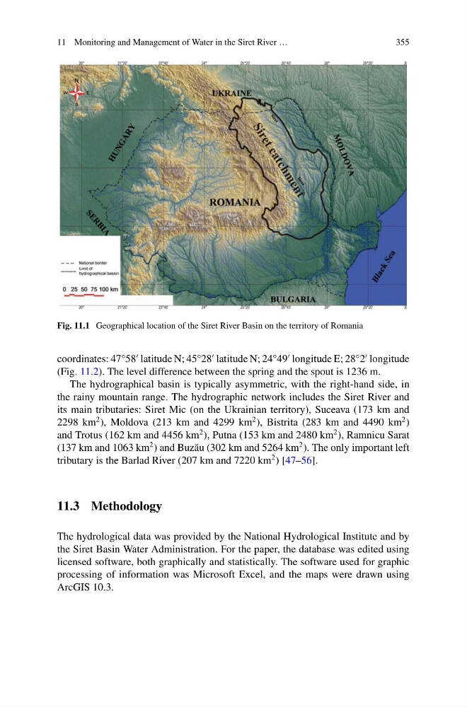
Fig. 11.1 Geographical location of the Siret River Basin on the territory of Romania
coordinates: 47°58
latitude N; 45°28
latitude N; 24°49
longitude E; 28°2
longitude
(Fig. 11.2). The level difference between the spring and the spout is 1236 m.
The hydrographical basin is typically asymmetric, with the right-hand side, in
the rainy mountain range. The hydrographic network includes the Siret River and
its main tributaries: Siret Mic (on the Ukrainian territory), Suceava (173 km and
2298 km
2 ), Moldova (213 km and 4299 km
2 ), Bistrita (283 km and 4490 km
2 )
and Trotus (162 km and 4456 km
2 ), Putna (153 km and 2480 km
2 ), Ramnicu Sarat
(137 km and 1063 km
2 ) and Buz˘ au (302 km and 5264 km
2 ). The only important left
tributary is the Barlad River (207 km and 7220 km
2 ) [47–56].
11.3 Methodology
The hydrological data was provided by the National Hydrological Institute and by
the Siret Basin Water Administration. For the paper, the database was edited using
licensed software, both graphically and statistically. The software used for graphic
processing of information was Microsoft Excel, and the maps were drawn using
ArcGIS 10.3.
355
Fig. 11.1 Geographical location of the Siret River Basin on the territory of Romania
coordinates: 47°58
latitude N; 45°28
latitude N; 24°49
longitude E; 28°2
longitude
(Fig. 11.2). The level difference between the spring and the spout is 1236 m.
The hydrographical basin is typically asymmetric, with the right-hand side, in
the rainy mountain range. The hydrographic network includes the Siret River and
its main tributaries: Siret Mic (on the Ukrainian territory), Suceava (173 km and
2298 km
2 ), Moldova (213 km and 4299 km
2 ), Bistrita (283 km and 4490 km
2 )
and Trotus (162 km and 4456 km
2 ), Putna (153 km and 2480 km
2 ), Ramnicu Sarat
(137 km and 1063 km
2 ) and Buz˘ au (302 km and 5264 km
2 ). The only important left
tributary is the Barlad River (207 km and 7220 km
2 ) [47–56].
11.3 Methodology
The hydrological data was provided by the National Hydrological Institute and by
the Siret Basin Water Administration. For the paper, the database was edited using
licensed software, both graphically and statistically. The software used for graphic
processing of information was Microsoft Excel, and the maps were drawn using
ArcGIS 10.3.