

152
F. Morar et al.
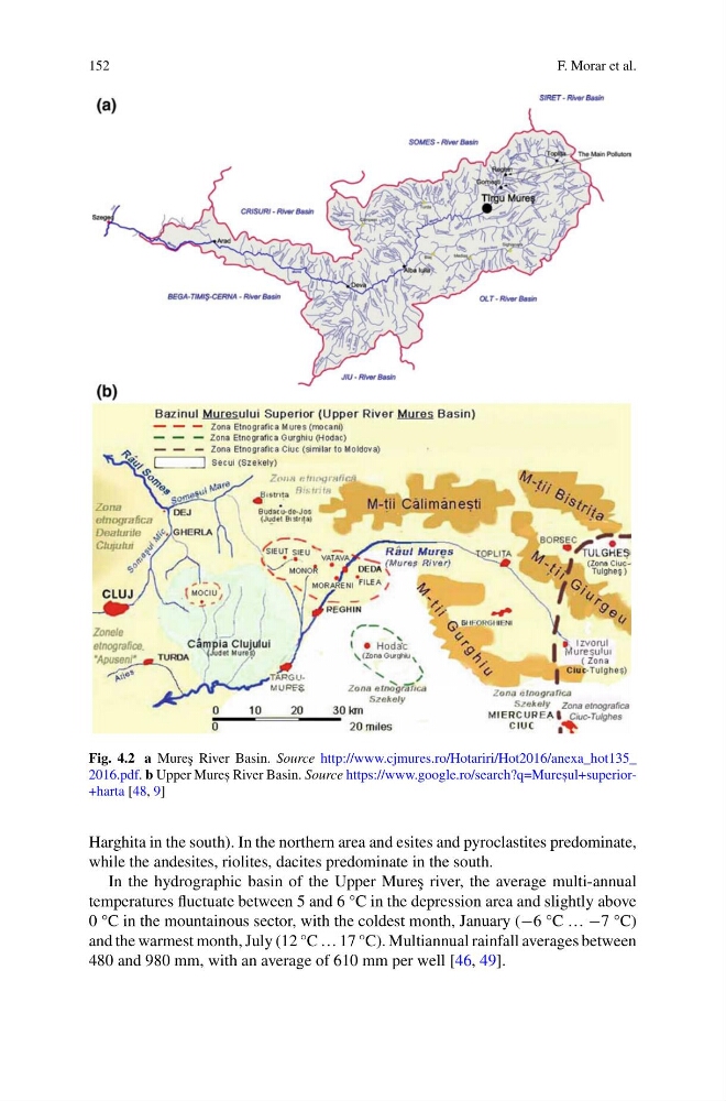
Fig. 4.2 a Mure¸ s River Basin. Source http://www.cjmures.ro/Hotariri/Hot2016/anexa_hot135_
2016.pdf. b Upper Mures , River Basin. Source https://www.google.ro/search?q=Mures , ul+superior+harta [48, 9]
Harghita in the south). In the northern area and esites and pyroclastites predominate,
while the andesites, riolites, dacites predominate in the south.
In the hydrographic basin of the Upper Mure¸ s river, the average multi-annual
temperatures fluctuate between 5 and 6 °C in the depression area and slightly above
0 °C in the mountainous sector, with the coldest month, January (−6 °C … −7 °C)
and the warmest month, July (12 °C … 17 °C). Multiannual rainfall averages between
480 and 980 mm, with an average of 610 mm per well [46, 49].
F. Morar et al.
Fig. 4.2 a Mure¸ s River Basin. Source http://www.cjmures.ro/Hotariri/Hot2016/anexa_hot135_
2016.pdf. b Upper Mures , River Basin. Source https://www.google.ro/search?q=Mures , ul+superior+harta [48, 9]
Harghita in the south). In the northern area and esites and pyroclastites predominate,
while the andesites, riolites, dacites predominate in the south.
In the hydrographic basin of the Upper Mure¸ s river, the average multi-annual
temperatures fluctuate between 5 and 6 °C in the depression area and slightly above
0 °C in the mountainous sector, with the coldest month, January (−6 °C … −7 °C)
and the warmest month, July (12 °C … 17 °C). Multiannual rainfall averages between
480 and 980 mm, with an average of 610 mm per well [46, 49].