

287
Communal Property Lands in Mexico
Communal land areas for Mexico were obtained from the Registro Agrario Nacional
(RAN) which is part of the Secretaria de Desarrollo Agrario, Territorial y Urbano
(SEDATU). These data consisted of two different GIS files in shapefile format. The
first file consists of polygons that denote the perimeters of certified agrarian nuclei
or ejidos (perimetrales de nucleos agrarios certificados). In this chapter we refer to
these polygons as RAN. The second file consists of polygons within the RAN polygons that depict lands that are used for productive communal land uses within the
ejidos. In this chapter, we call these second type of polygons TUC (Tierra de uso
comun). While RAN polygons include the population centers (human settlement
built up lands) as well as parceled land for “private use” within the ejidos, TUC
polygons/lands do not. TUC lands constitute the economic source of communal life
in each ejido. We used the most updated version (2018) of both TUC and RAN
lands (polygons), since we are interested on the status of those communities in the
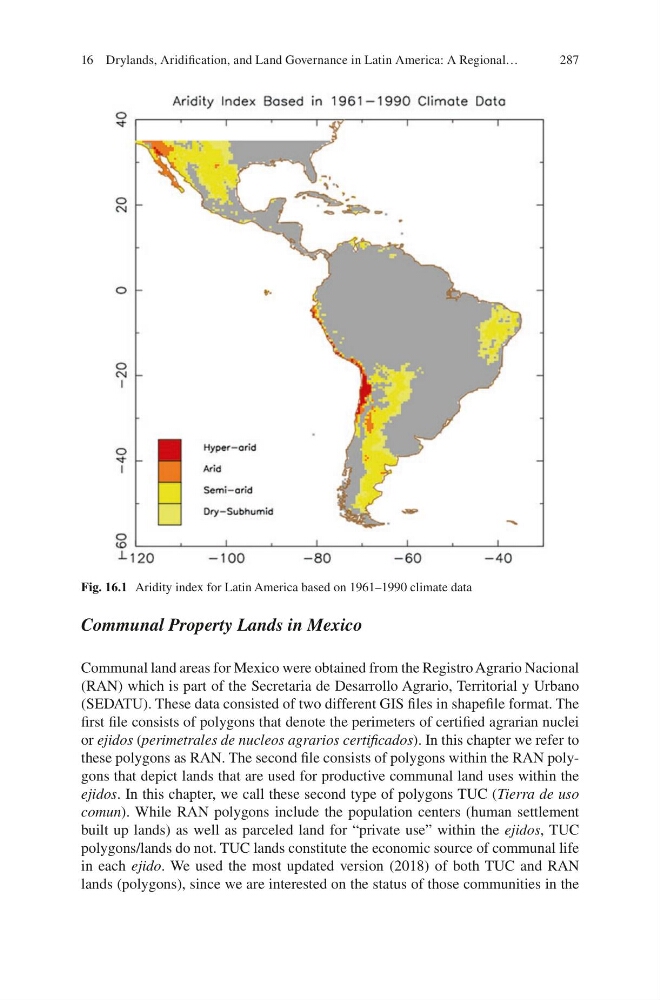
Fig. 16.1 Aridity index for Latin America based on 1961–1990 climate data
16 Drylands, Aridification, and Land Governance in Latin America: A Regional…
Communal Property Lands in Mexico
Communal land areas for Mexico were obtained from the Registro Agrario Nacional
(RAN) which is part of the Secretaria de Desarrollo Agrario, Territorial y Urbano
(SEDATU). These data consisted of two different GIS files in shapefile format. The
first file consists of polygons that denote the perimeters of certified agrarian nuclei
or ejidos (perimetrales de nucleos agrarios certificados). In this chapter we refer to
these polygons as RAN. The second file consists of polygons within the RAN polygons that depict lands that are used for productive communal land uses within the
ejidos. In this chapter, we call these second type of polygons TUC (Tierra de uso
comun). While RAN polygons include the population centers (human settlement
built up lands) as well as parceled land for “private use” within the ejidos, TUC
polygons/lands do not. TUC lands constitute the economic source of communal life
in each ejido. We used the most updated version (2018) of both TUC and RAN
lands (polygons), since we are interested on the status of those communities in the
Fig. 16.1 Aridity index for Latin America based on 1961–1990 climate data
16 Drylands, Aridification, and Land Governance in Latin America: A Regional…