

Building Collaborative Partnerships: An Example …
627
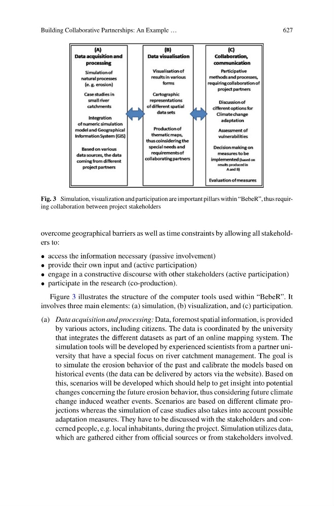
Fig. 3 Simulation, visualization and participation are important pillars within “BebeR”, thus requiring collaboration between project stakeholders
overcome geographical barriers as well as time constraints by allowing all stakeholders to:
• access the information necessary (passive involvement)
• provide their own input and (active participation)
• engage in a constructive discourse with other stakeholders (active participation)
• participate in the research (co-production).
Figure 3 illustrates the structure of the computer tools used within “BebeR”. It
involves three main elements: (a) simulation, (b) visualization, and (c) participation.
(a) Data acquisition and processing: Data, foremost spatial information, is provided
by various actors, including citizens. The data is coordinated by the university
that integrates the different datasets as part of an online mapping system. The
simulation tools will be developed by experienced scientists from a partner university that have a special focus on river catchment management. The goal is
to simulate the erosion behavior of the past and calibrate the models based on
historical events (the data can be delivered by actors via the website). Based on
this, scenarios will be developed which should help to get insight into potential
changes concerning the future erosion behavior, thus considering future climate
change induced weather events. Scenarios are based on different climate projections whereas the simulation of case studies also takes into account possible
adaptation measures. They have to be discussed with the stakeholders and concerned people, e.g. local inhabitants, during the project. Simulation utilizes data,
which are gathered either from official sources or from stakeholders involved.