

527
19.2 The Great Lakes Region of North America
19.2.1 Background
The Great Lakes region of North America is part of the St. Lawrence River
Watershed, which is among the 20 largest drainage basins in the world. The watershed drains to the Atlantic Ocean and spans two countries, including eight states in
the USA and two provinces in Canada, as well as 60 major cities. The North
American Great Lakes Basin is situated at an altitude that ranges between 74 m
(Lake Ontario) and 183 m (Lake Superior) (ILEC 2005). A map of the North
American Great Lakes Basin is presented below in Fig. 19.1.
The Laurentian Great Lakes of North America are the largest surface freshwater
system on the Earth, containing approximately 84% of the continent’s surface fresh
water, and about 21% of the world’s supply of surface fresh water. The Great Lakes
drain through the St. Lawrence River, which flows about 1200 km
2
before emptying
into the Gulf of St. Lawrence, the largest estuary in the world. While the drainage
area of the Great Lakes covers more than 520,000 km
2
, the drainage area of the
entire Laurentian system (including the St. Lawrence River) is approximately one
million km
2
. In 2013, the Great Lakes supplied over 42 billion gallons of water per
day for residential, agricultural and industrial use to more than 33 million people
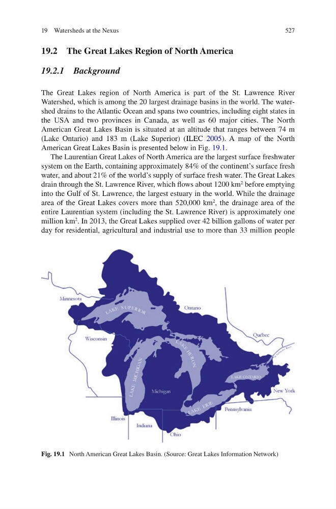
Fig. 19.1 North American Great Lakes Basin. (Source: Great Lakes Information Network)
19 Watersheds at the Nexus
19.2 The Great Lakes Region of North America
19.2.1 Background
The Great Lakes region of North America is part of the St. Lawrence River
Watershed, which is among the 20 largest drainage basins in the world. The watershed drains to the Atlantic Ocean and spans two countries, including eight states in
the USA and two provinces in Canada, as well as 60 major cities. The North
American Great Lakes Basin is situated at an altitude that ranges between 74 m
(Lake Ontario) and 183 m (Lake Superior) (ILEC 2005). A map of the North
American Great Lakes Basin is presented below in Fig. 19.1.
The Laurentian Great Lakes of North America are the largest surface freshwater
system on the Earth, containing approximately 84% of the continent’s surface fresh
water, and about 21% of the world’s supply of surface fresh water. The Great Lakes
drain through the St. Lawrence River, which flows about 1200 km
2
before emptying
into the Gulf of St. Lawrence, the largest estuary in the world. While the drainage
area of the Great Lakes covers more than 520,000 km
2
, the drainage area of the
entire Laurentian system (including the St. Lawrence River) is approximately one
million km
2
. In 2013, the Great Lakes supplied over 42 billion gallons of water per
day for residential, agricultural and industrial use to more than 33 million people
Fig. 19.1 North American Great Lakes Basin. (Source: Great Lakes Information Network)
19 Watersheds at the Nexus