

447
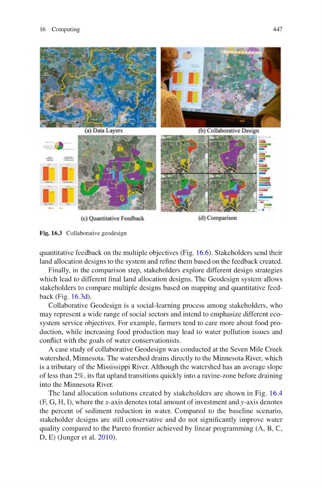
Fig. 16.3 Collaborative geodesign
quantitative feedback on the multiple objectives (Fig. 16.6). Stakeholders send their
land allocation designs to the system and refine them based on the feedback created.
Finally, in the comparison step, stakeholders explore different design strategies
which lead to different final land allocation designs. The Geodesign system allows
stakeholders to compare multiple designs based on mapping and quantitative feedback (Fig. 16.3d).
Collaborative Geodesign is a social-learning process among stakeholders, who
may represent a wide range of social sectors and intend to emphasize different ecosystem service objectives. For example, farmers tend to care more about food production, while increasing food production may lead to water pollution issues and
conflict with the goals of water conservationists.
A case study of collaborative Geodesign was conducted at the Seven Mile Creek
watershed, Minnesota. The watershed drains directly to the Minnesota River, which
is a tributary of the Mississippi River. Although the watershed has an average slope
of less than 2%, its flat upland transitions quickly into a ravine-zone before draining
into the Minnesota River.
The land allocation solutions created by stakeholders are shown in Fig. 16.4
(F, G, H, I), where the x-axis denotes total amount of investment and y-axis denotes
the percent of sediment reduction in water. Compared to the baseline scenario,
stakeholder designs are still conservative and do not significantly improve water
quality compared to the Pareto frontier achieved by linear programming (A, B, C,
D, E) (Junger et al. 2010).
16 Computing
Fig. 16.3 Collaborative geodesign
quantitative feedback on the multiple objectives (Fig. 16.6). Stakeholders send their
land allocation designs to the system and refine them based on the feedback created.
Finally, in the comparison step, stakeholders explore different design strategies
which lead to different final land allocation designs. The Geodesign system allows
stakeholders to compare multiple designs based on mapping and quantitative feedback (Fig. 16.3d).
Collaborative Geodesign is a social-learning process among stakeholders, who
may represent a wide range of social sectors and intend to emphasize different ecosystem service objectives. For example, farmers tend to care more about food production, while increasing food production may lead to water pollution issues and
conflict with the goals of water conservationists.
A case study of collaborative Geodesign was conducted at the Seven Mile Creek
watershed, Minnesota. The watershed drains directly to the Minnesota River, which
is a tributary of the Mississippi River. Although the watershed has an average slope
of less than 2%, its flat upland transitions quickly into a ravine-zone before draining
into the Minnesota River.
The land allocation solutions created by stakeholders are shown in Fig. 16.4
(F, G, H, I), where the x-axis denotes total amount of investment and y-axis denotes
the percent of sediment reduction in water. Compared to the baseline scenario,
stakeholder designs are still conservative and do not significantly improve water
quality compared to the Pareto frontier achieved by linear programming (A, B, C,
D, E) (Junger et al. 2010).
16 Computing