

32
Scientific system models created by the representatives of different scientific fields can be classified into three groups.
1. Earth models exposing the geological structures and related processes from the solid
Earth’s surface to the centre of Earth.
2. Models containing the so-called outer spheres
(pedosphere, hydrosphere, atmosphere, biosphere): e.g. global climate models, biosphere
models.
3. “World models” plotting the operation of the
global society.
In the first two groups the fundamental aims
of creating the system models is to expose the
structure and operation of Earth’s environment
independent of humanity. “World models” in the
third group are designed to reveal the operation
mechanism, sustainability or untenableness of
the human society. It has to be noted, however,
that system models in the second group cannot
ignore integrating social impact in their model
(e.g. global climate models and the integration of
the role of anthropogenic greenhouse gases)
while “world models” of group three cannot
ignore the roles of energy and raw material
resources of the natural environment and environmental pollution in sustaining the society.
Let us consider the essence of some of the
most important global models.
2.6.1 PREM Model and the New
Global Geodynamic Model
Geophysicists explore the internal structure of
Earth primarily on the basis of studying the mitigation of earthquake waves (seismology). The
results revealed that our planet is composed of
spheres from its solid surface to the centre. At the
end of the twentieth century scientists agreed on
the following structure based on the generally
accepted PREM (Preliminary Reference Earth
Model) (Dziewonski and Anderson 1981).
Earth’s crust is found between the solid surface
and the Mohorovičič surface (MOHO surface).
The crust is only 5 km thick under oceans while
depending on the relief and the age of the rocks it
can be a few tens of kilometres thick under the
continents. The upper part of the mantle is found
between the MOHO surface and 650–700 km.
The top 60–120 km of the upper mantle together
with the crust on it form lithospheric plates.
Under the plates the asthenosphere is found
between the depths of 120 and 410 km (Fig. 2.15).
Although the entire mantle is in a solid state seismic waves slowdown in the asthenosphere and
scientists believe that its state is plastic. The
asthenosphere has an important role in plate tectonics as the lithospheric plates are moved by the
material and energy flows in it called convection
currents and the primary magma chamber of
many volcanoes are also found here.
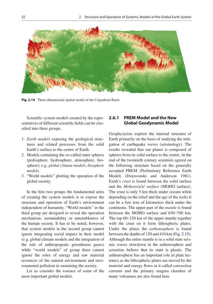
Fig. 2.14 Three-dimensional spatial model of the Carpathian Basin
2 Structure and Operation of Systems, Models of the Global Earth System
Scientific system models created by the representatives of different scientific fields can be classified into three groups.
1. Earth models exposing the geological structures and related processes from the solid
Earth’s surface to the centre of Earth.
2. Models containing the so-called outer spheres
(pedosphere, hydrosphere, atmosphere, biosphere): e.g. global climate models, biosphere
models.
3. “World models” plotting the operation of the
global society.
In the first two groups the fundamental aims
of creating the system models is to expose the
structure and operation of Earth’s environment
independent of humanity. “World models” in the
third group are designed to reveal the operation
mechanism, sustainability or untenableness of
the human society. It has to be noted, however,
that system models in the second group cannot
ignore integrating social impact in their model
(e.g. global climate models and the integration of
the role of anthropogenic greenhouse gases)
while “world models” of group three cannot
ignore the roles of energy and raw material
resources of the natural environment and environmental pollution in sustaining the society.
Let us consider the essence of some of the
most important global models.
2.6.1 PREM Model and the New
Global Geodynamic Model
Geophysicists explore the internal structure of
Earth primarily on the basis of studying the mitigation of earthquake waves (seismology). The
results revealed that our planet is composed of
spheres from its solid surface to the centre. At the
end of the twentieth century scientists agreed on
the following structure based on the generally
accepted PREM (Preliminary Reference Earth
Model) (Dziewonski and Anderson 1981).
Earth’s crust is found between the solid surface
and the Mohorovičič surface (MOHO surface).
The crust is only 5 km thick under oceans while
depending on the relief and the age of the rocks it
can be a few tens of kilometres thick under the
continents. The upper part of the mantle is found
between the MOHO surface and 650–700 km.
The top 60–120 km of the upper mantle together
with the crust on it form lithospheric plates.
Under the plates the asthenosphere is found
between the depths of 120 and 410 km (Fig. 2.15).
Although the entire mantle is in a solid state seismic waves slowdown in the asthenosphere and
scientists believe that its state is plastic. The
asthenosphere has an important role in plate tectonics as the lithospheric plates are moved by the
material and energy flows in it called convection
currents and the primary magma chamber of
many volcanoes are also found here.
Fig. 2.14 Three-dimensional spatial model of the Carpathian Basin
2 Structure and Operation of Systems, Models of the Global Earth System