

Measuring the Implementation of Sustainable Development …
219
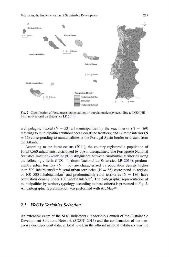
Fig. 2 Classification of Portuguese municipalities by population density according to INE (INE—
Instituto Nacional de Estatística I.P. 2014)
archipelagos; littoral (N = 53) all municipalities by the sea; interior (N = 169)
referring to municipalities without ocean coastline frontiers; and extreme interior (N
= 56) corresponding to municipalities at the Portugal-Spain border or distant from
the Atlantic.
According to the latest census (2011), the country registered a population of
10,557,560 inhabitants, distributed by 308 municipalities. The Portuguese National
Statistics Institute (www.ine.pt) distinguishes between rural/urban territories using
the following criteria (INE—Instituto Nacional de Estatística I.P. 2014): predominantly urban territory (N = 36) are characterized by population density higher
than 500 inhabitants/km
2 ; semi-urban territories (N = 86) correspond to regions
of 100–500 inhabitants/km
2 and predominantly rural territories (N = 186) have
population density under 100 inhabitants/km
2 . The cartographic representation of
municipalities by territory typology according to these criteria is presented at Fig. 2.
All cartographic representation was performed with ArcMap™.
2.1 WeGIx Variables Selection
An extensive exam of the SDG Indicators (Leadership Council of the Sustainable
Development Solutions Network (SDSN) 2015) and the confirmation of the necessary correspondent data, at local level, in the official national databases was the
219
Fig. 2 Classification of Portuguese municipalities by population density according to INE (INE—
Instituto Nacional de Estatística I.P. 2014)
archipelagos; littoral (N = 53) all municipalities by the sea; interior (N = 169)
referring to municipalities without ocean coastline frontiers; and extreme interior (N
= 56) corresponding to municipalities at the Portugal-Spain border or distant from
the Atlantic.
According to the latest census (2011), the country registered a population of
10,557,560 inhabitants, distributed by 308 municipalities. The Portuguese National
Statistics Institute (www.ine.pt) distinguishes between rural/urban territories using
the following criteria (INE—Instituto Nacional de Estatística I.P. 2014): predominantly urban territory (N = 36) are characterized by population density higher
than 500 inhabitants/km
2 ; semi-urban territories (N = 86) correspond to regions
of 100–500 inhabitants/km
2 and predominantly rural territories (N = 186) have
population density under 100 inhabitants/km
2 . The cartographic representation of
municipalities by territory typology according to these criteria is presented at Fig. 2.
All cartographic representation was performed with ArcMap™.
2.1 WeGIx Variables Selection
An extensive exam of the SDG Indicators (Leadership Council of the Sustainable
Development Solutions Network (SDSN) 2015) and the confirmation of the necessary correspondent data, at local level, in the official national databases was the