

6.2.2 Study Sites
Semi-arid Ghana formally comprises of three political and administrative regions,
namely Northern, Upper East and Upper West (Saito et al. 2018a). The three regions
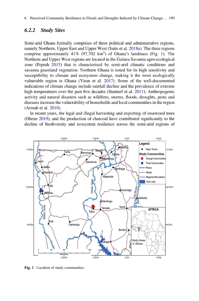
comprise approximately 41% (97,702 km
2 ) of Ghana’s landmass (Fig. 1). The
Northern and Upper West regions are located in the Guinea Savanna agro-ecological
zone (Peprah 2015) that is characterized by semi-arid climatic conditions and
savanna grassland vegetation. Northern Ghana is noted for its high sensitivity and
susceptibility to climate and ecosystem change, making it the most ecologically
vulnerable region in Ghana (Yiran et al. 2017). Some of the well-documented
indications of climate change include rainfall decline and the prevalence of extreme
high temperatures over the past five decades (Stanturf et al. 2011). Anthropogenic
activity and natural disasters such as wildfires, storms, floods, droughts, pests and
diseases increase the vulnerability of households and local communities in the region
(Armah et al. 2010).
In recent years, the legal and illegal harvesting and exporting of rosewood trees
(Ohene 2019), and the production of charcoal have contributed significantly to the
decline of biodiversity and ecosystem resilience across the semi-arid regions of
Fig. 1 Location of study communities
6 Perceived Community Resilience to Floods and Droughts Induced by Climate Change. . . 199
Semi-arid Ghana formally comprises of three political and administrative regions,
namely Northern, Upper East and Upper West (Saito et al. 2018a). The three regions
comprise approximately 41% (97,702 km
2 ) of Ghana’s landmass (Fig. 1). The
Northern and Upper West regions are located in the Guinea Savanna agro-ecological
zone (Peprah 2015) that is characterized by semi-arid climatic conditions and
savanna grassland vegetation. Northern Ghana is noted for its high sensitivity and
susceptibility to climate and ecosystem change, making it the most ecologically
vulnerable region in Ghana (Yiran et al. 2017). Some of the well-documented
indications of climate change include rainfall decline and the prevalence of extreme
high temperatures over the past five decades (Stanturf et al. 2011). Anthropogenic
activity and natural disasters such as wildfires, storms, floods, droughts, pests and
diseases increase the vulnerability of households and local communities in the region
(Armah et al. 2010).
In recent years, the legal and illegal harvesting and exporting of rosewood trees
(Ohene 2019), and the production of charcoal have contributed significantly to the
decline of biodiversity and ecosystem resilience across the semi-arid regions of
Fig. 1 Location of study communities
6 Perceived Community Resilience to Floods and Droughts Induced by Climate Change. . . 199