

319
complexity, low spatial overlap, and low number of species (Lopatin et al. 2017).
Schweiger et al. (2018) showed a strong relationship between functional diversity of
grassland species and spectral traits collected using a hyperspectral sensor mounted
on a scaffolding. Following this new approach, detection of individuals is no longer
needed to monitor functional aspects of biodiversity. If models are to be developed
that link the spectral signals to properties of plant diversity, it is important that both
the field data collection and the image campaign are synchronized, particular in
highly dynamic ecosystems such as grasslands with high land-use intensities. The
high flexibility of UAS is a major advantage in such situations.
In vegetated ecosystems, vegetation structure is a key characteristic that is
strongly related to the diversity of many taxa. UAS high-resolution images are used
to characterize different aspects of vegetation structure: Getzin et al. (2014) used
high-resolution RGB images to create canopy gap maps. They showed strong relations between spatial gap metrics and herbal plant species diversity in temperate
forests. 3-D point clouds derived from UAS images can be used to characterize the
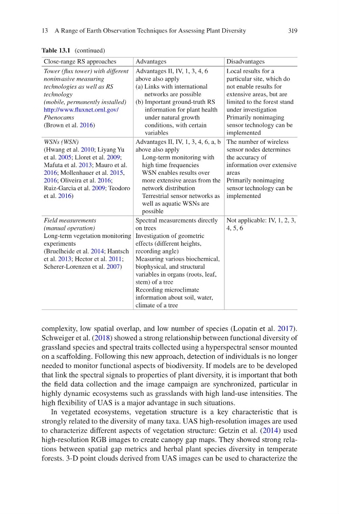
Table 13.1 (continued)
Close-range RS approaches
Advantages
Disadvantages
Tower (flux tower) with different
noninvasive measuring
technologies as well as RS
technology
(mobile, permanently installed)
http://www.fluxnet.ornl.gov/
Phenocams
(Brown et al. 2016)
Advantages II, IV, 1, 3, 4, 6
above also apply
(a) Links with international
networks are possible
(b) Important ground-truth RS
information for plant health
under natural growth
conditions, with certain
variables
Local results for a
particular site, which do
not enable results for
extensive areas, but are
limited to the forest stand
under investigation
Primarily nonimaging
sensor technology can be
implemented
WSNs (WSN)
(Hwang et al. 2010; Liyang Yu
et al. 2005; Lloret et al. 2009;
Mafuta et al. 2013; Mauro et al.
2016; Mollenhauer et al. 2015,
2016; Oliveira et al. 2016;
Ruiz-Garcia et al. 2009; Teodoro
et al. 2016)
Advantages II, IV, 1, 3, 4, 6, a, b
above also apply
Long-term monitoring with
high time frequencies
WSN enables results over
more extensive areas from the
network distribution
Terrestrial sensor networks as
well as aquatic WSNs are
possible
The number of wireless
sensor nodes determines
the accuracy of
information over extensive
areas
Primarily nonimaging
sensor technology can be
implemented
Field measurements
(manual operation)
Long-term vegetation monitoring
experiments
(Bruelheide et al. 2014; Hantsch
et al. 2013; Hector et al. 2011;
Scherer-Lorenzen et al. 2007)
Spectral measurements directly
on trees
Investigation of geometric
effects (different heights,
recording angle)
Measuring various biochemical,
biophysical, and structural
variables in organs (roots, leaf,
stem) of a tree
Recording microclimate
information about soil, water,
climate of a tree
Not applicable: IV, 1, 2, 3,
4, 5, 6
13 A Range of Earth Observation Techniques for Assessing Plant Diversity
complexity, low spatial overlap, and low number of species (Lopatin et al. 2017).
Schweiger et al. (2018) showed a strong relationship between functional diversity of
grassland species and spectral traits collected using a hyperspectral sensor mounted
on a scaffolding. Following this new approach, detection of individuals is no longer
needed to monitor functional aspects of biodiversity. If models are to be developed
that link the spectral signals to properties of plant diversity, it is important that both
the field data collection and the image campaign are synchronized, particular in
highly dynamic ecosystems such as grasslands with high land-use intensities. The
high flexibility of UAS is a major advantage in such situations.
In vegetated ecosystems, vegetation structure is a key characteristic that is
strongly related to the diversity of many taxa. UAS high-resolution images are used
to characterize different aspects of vegetation structure: Getzin et al. (2014) used
high-resolution RGB images to create canopy gap maps. They showed strong relations between spatial gap metrics and herbal plant species diversity in temperate
forests. 3-D point clouds derived from UAS images can be used to characterize the
Table 13.1 (continued)
Close-range RS approaches
Advantages
Disadvantages
Tower (flux tower) with different
noninvasive measuring
technologies as well as RS
technology
(mobile, permanently installed)
http://www.fluxnet.ornl.gov/
Phenocams
(Brown et al. 2016)
Advantages II, IV, 1, 3, 4, 6
above also apply
(a) Links with international
networks are possible
(b) Important ground-truth RS
information for plant health
under natural growth
conditions, with certain
variables
Local results for a
particular site, which do
not enable results for
extensive areas, but are
limited to the forest stand
under investigation
Primarily nonimaging
sensor technology can be
implemented
WSNs (WSN)
(Hwang et al. 2010; Liyang Yu
et al. 2005; Lloret et al. 2009;
Mafuta et al. 2013; Mauro et al.
2016; Mollenhauer et al. 2015,
2016; Oliveira et al. 2016;
Ruiz-Garcia et al. 2009; Teodoro
et al. 2016)
Advantages II, IV, 1, 3, 4, 6, a, b
above also apply
Long-term monitoring with
high time frequencies
WSN enables results over
more extensive areas from the
network distribution
Terrestrial sensor networks as
well as aquatic WSNs are
possible
The number of wireless
sensor nodes determines
the accuracy of
information over extensive
areas
Primarily nonimaging
sensor technology can be
implemented
Field measurements
(manual operation)
Long-term vegetation monitoring
experiments
(Bruelheide et al. 2014; Hantsch
et al. 2013; Hector et al. 2011;
Scherer-Lorenzen et al. 2007)
Spectral measurements directly
on trees
Investigation of geometric
effects (different heights,
recording angle)
Measuring various biochemical,
biophysical, and structural
variables in organs (roots, leaf,
stem) of a tree
Recording microclimate
information about soil, water,
climate of a tree
Not applicable: IV, 1, 2, 3,
4, 5, 6
13 A Range of Earth Observation Techniques for Assessing Plant Diversity