

145
To improve insect and disease surveys and facilitate the use of forest health information that RS products can provide, the USFS has recently initiated the Operational
Remote Sensing (ORS) program. Similar to the FDM, ORS will use a phenologybased approach to intensifying surveys using 30 m Landsat and other moderateresolution data.
Ecosystem Disturbance and Recovery Tracker (eDaRT) http://www.cstarsd3s.
ucdavis.edu/systems/edart/ A collaboration among the University of California,
Davis, Center for Southeastern Tropical Advanced Remote Sensing (CSTARS), and
the US Forest Service, the Ecosystem Disturbance and Recovery Tracker (eDaRT;
Koltunov et al. 2015) is an automated system that provides a suite of Landsatderived products to identify and categorize changes in forest, shrubland, and herbaceous ecosystems. Currently, eDaRT products are not publicly available, but recent
efforts are focused on expanding operations by the US Forest Service in California
and elsewhere in the western United States in support of daily ecosystem management tasks.
Looking Ahead Because of the vast potential for RS to inform the sustainable
management of terrestrial landscapes, there are several new Earth observation missions on the horizon. The European Space Agency (ESA) will launch Earth Explorer
7 in 2021 (https://www.esa.int/Our_Activities/Observing_the_Earth). This ecology
mission, known as Biomass, is designed to characterize forests. The Biomass mission will be followed by the Earth Explorer 8 Fluorescence Explorer (FLEX) mission in 2022, with capabilities to quantify chlorophyll fluorescence in terrestrial
vegetation. Landsat 9, part of the Earth observation data continuity mission from
NASA (fast-tracked for December 2020 launch date), will maintain nearly 50 years
of continuous Earth observation. This instrument is designed to simultaneously
image 11 spectral bands, including a 15 m panchromatic band, with 12 bit radiometric resolution to increase sensitivity to small differences in reflectance. Such
advances are critical to the early stress detection and detailed decline assessment
that land managers need.
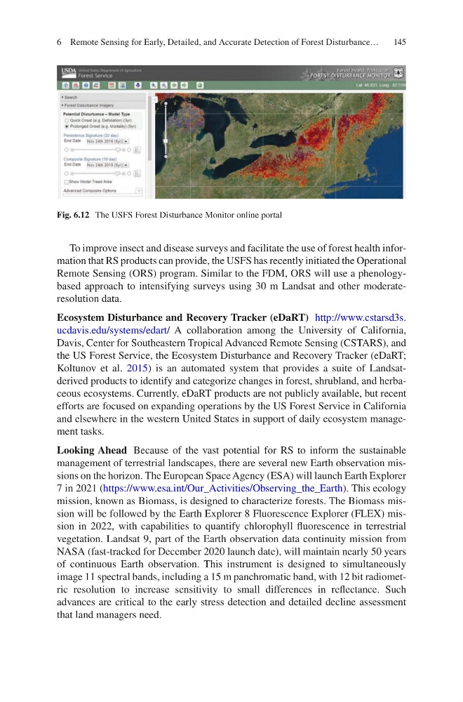
Fig. 6.12 The USFS Forest Disturbance Monitor online portal
6 Remote Sensing for Early, Detailed, and Accurate Detection of Forest Disturbance…
To improve insect and disease surveys and facilitate the use of forest health information that RS products can provide, the USFS has recently initiated the Operational
Remote Sensing (ORS) program. Similar to the FDM, ORS will use a phenologybased approach to intensifying surveys using 30 m Landsat and other moderateresolution data.
Ecosystem Disturbance and Recovery Tracker (eDaRT) http://www.cstarsd3s.
ucdavis.edu/systems/edart/ A collaboration among the University of California,
Davis, Center for Southeastern Tropical Advanced Remote Sensing (CSTARS), and
the US Forest Service, the Ecosystem Disturbance and Recovery Tracker (eDaRT;
Koltunov et al. 2015) is an automated system that provides a suite of Landsatderived products to identify and categorize changes in forest, shrubland, and herbaceous ecosystems. Currently, eDaRT products are not publicly available, but recent
efforts are focused on expanding operations by the US Forest Service in California
and elsewhere in the western United States in support of daily ecosystem management tasks.
Looking Ahead Because of the vast potential for RS to inform the sustainable
management of terrestrial landscapes, there are several new Earth observation missions on the horizon. The European Space Agency (ESA) will launch Earth Explorer
7 in 2021 (https://www.esa.int/Our_Activities/Observing_the_Earth). This ecology
mission, known as Biomass, is designed to characterize forests. The Biomass mission will be followed by the Earth Explorer 8 Fluorescence Explorer (FLEX) mission in 2022, with capabilities to quantify chlorophyll fluorescence in terrestrial
vegetation. Landsat 9, part of the Earth observation data continuity mission from
NASA (fast-tracked for December 2020 launch date), will maintain nearly 50 years
of continuous Earth observation. This instrument is designed to simultaneously
image 11 spectral bands, including a 15 m panchromatic band, with 12 bit radiometric resolution to increase sensitivity to small differences in reflectance. Such
advances are critical to the early stress detection and detailed decline assessment
that land managers need.
Fig. 6.12 The USFS Forest Disturbance Monitor online portal
6 Remote Sensing for Early, Detailed, and Accurate Detection of Forest Disturbance…