

128
The use of multispectral sensors to identify more subtle or early decline symptoms is typically limited by the spectral resolution (few, broad-bands of spectral
information to work with), spatial resolution (mixes of healthy and stressed vegetation in one pixel often mask the spectral stress signature of stressed individual
trees), and temporal resolution (inability to acquire cloud-free images at intervals
sufficient to detect change).
As the interest in RS products has grown, along with the range of applications,
many commercial vendors have expanded access to multispectral products with
both aerial and satellite platforms. We now have over 100 active satellite sensors
with visible and NIR capabilities listed in the International Inst. for Aerospace
Survey and Earth Sciences (Netherlands; formerly International Training Centre for
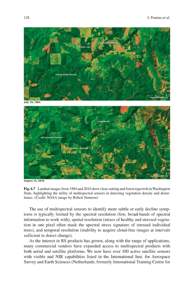
Fig. 6.7 Landsat images from 1984 and 2010 show clear-cutting and forest regrowth in Washington
State, highlighting the utility of multispectral sensors in detecting vegetation density and disturbance. (Credit: NASA image by Robert Simmon)
J. Pontius et al.
The use of multispectral sensors to identify more subtle or early decline symptoms is typically limited by the spectral resolution (few, broad-bands of spectral
information to work with), spatial resolution (mixes of healthy and stressed vegetation in one pixel often mask the spectral stress signature of stressed individual
trees), and temporal resolution (inability to acquire cloud-free images at intervals
sufficient to detect change).
As the interest in RS products has grown, along with the range of applications,
many commercial vendors have expanded access to multispectral products with
both aerial and satellite platforms. We now have over 100 active satellite sensors
with visible and NIR capabilities listed in the International Inst. for Aerospace
Survey and Earth Sciences (Netherlands; formerly International Training Centre for
Fig. 6.7 Landsat images from 1984 and 2010 show clear-cutting and forest regrowth in Washington
State, highlighting the utility of multispectral sensors in detecting vegetation density and disturbance. (Credit: NASA image by Robert Simmon)
J. Pontius et al.