

98
the RT model by the PAI voxel grid. If LOPs can be assumed to be uniform across
a site or region, the presented approach can be used for larger areas, only relying on
ALS data to parameterize the RT model and using the LOPs measured at a subset of
the site or taken from spectral libraries. ALS data are generally available at regional
and national scales, effectively bridging the gap between point-based field inventories and global scale satellite imagery. Using such larger-scale simulated EO data,
retrieval methods for RS-EBV primary observables such as CHL and vegetation
height can be tested and validated. The 3-D simulation environment we established
explicitly or implicitly contains all these variables in an easily retrievable format.
4.5.2 Functional Diversity of Laegeren Site
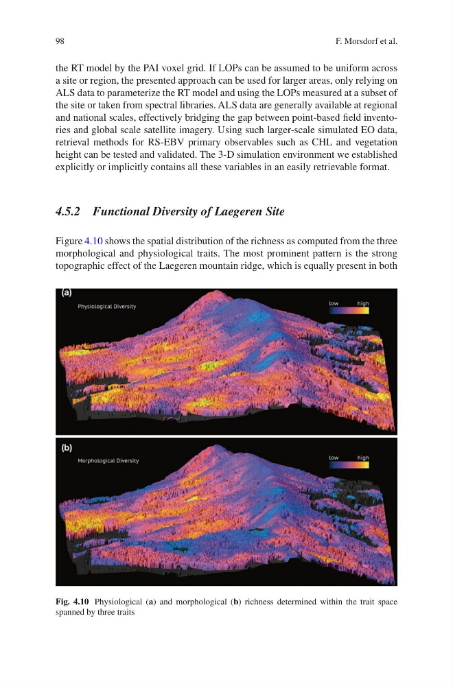
Figure 4.10 shows the spatial distribution of the richness as computed from the three
morphological and physiological traits. The most prominent pattern is the strong
topographic effect of the Laegeren mountain ridge, which is equally present in both
Fig. 4.10 Physiological (a) and morphological (b) richness determined within the trait space
spanned by three traits
F. Morsdorf et al.
the RT model by the PAI voxel grid. If LOPs can be assumed to be uniform across
a site or region, the presented approach can be used for larger areas, only relying on
ALS data to parameterize the RT model and using the LOPs measured at a subset of
the site or taken from spectral libraries. ALS data are generally available at regional
and national scales, effectively bridging the gap between point-based field inventories and global scale satellite imagery. Using such larger-scale simulated EO data,
retrieval methods for RS-EBV primary observables such as CHL and vegetation
height can be tested and validated. The 3-D simulation environment we established
explicitly or implicitly contains all these variables in an easily retrievable format.
4.5.2 Functional Diversity of Laegeren Site
Figure 4.10 shows the spatial distribution of the richness as computed from the three
morphological and physiological traits. The most prominent pattern is the strong
topographic effect of the Laegeren mountain ridge, which is equally present in both
Fig. 4.10 Physiological (a) and morphological (b) richness determined within the trait space
spanned by three traits
F. Morsdorf et al.