

224
(Baldi et al. 2019). Instead, its implementation is decided according to an estimate
of the costs for the clearing (eventually for the payment of fines and the final productive abandonment of the property) and the profits during its productive phase,
thus guaranteeing an adequate earning in relation with the capital invested.
Irrigation areas also show environmental deterioration problems. Due to the lack
of adequate drainage infrastructure and the low quality of the irrigation water, there
is a widespread and growing salinization process. This has led to the abandonment
of agricultural activities, in some areas almost completely (Taleisnik et al. 2008),
with consequent social and economic problems.
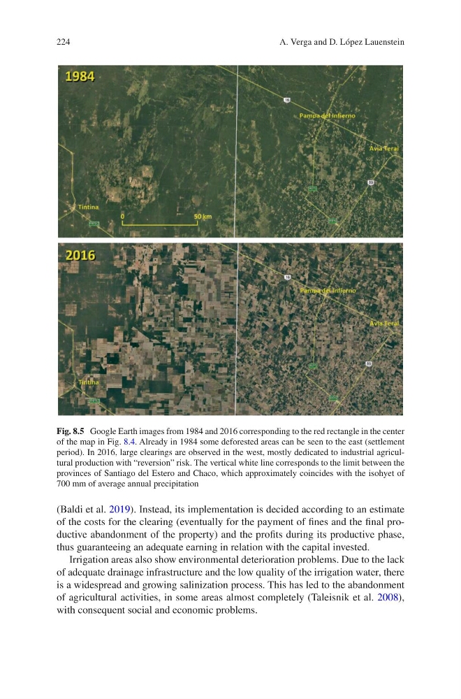
Fig. 8.5 Google Earth images from 1984 and 2016 corresponding to the red rectangle in the center
of the map in Fig. 8.4. Already in 1984 some deforested areas can be seen to the east (settlement
period). In 2016, large clearings are observed in the west, mostly dedicated to industrial agricultural production with “reversion” risk. The vertical white line corresponds to the limit between the
provinces of Santiago del Estero and Chaco, which approximately coincides with the isohyet of
700 mm of average annual precipitation
A. Verga and D. López Lauenstein
(Baldi et al. 2019). Instead, its implementation is decided according to an estimate
of the costs for the clearing (eventually for the payment of fines and the final productive abandonment of the property) and the profits during its productive phase,
thus guaranteeing an adequate earning in relation with the capital invested.
Irrigation areas also show environmental deterioration problems. Due to the lack
of adequate drainage infrastructure and the low quality of the irrigation water, there
is a widespread and growing salinization process. This has led to the abandonment
of agricultural activities, in some areas almost completely (Taleisnik et al. 2008),
with consequent social and economic problems.
Fig. 8.5 Google Earth images from 1984 and 2016 corresponding to the red rectangle in the center
of the map in Fig. 8.4. Already in 1984 some deforested areas can be seen to the east (settlement
period). In 2016, large clearings are observed in the west, mostly dedicated to industrial agricultural production with “reversion” risk. The vertical white line corresponds to the limit between the
provinces of Santiago del Estero and Chaco, which approximately coincides with the isohyet of
700 mm of average annual precipitation
A. Verga and D. López Lauenstein