

strata was due to land cover heterogeneity (i.e., unevenly distributed cropland within
the PSUs) as the validation segments are randomly sampled within the PSUs. It is
difficult to define a stratum 12 or 20 PSU that is homogeneous unless it is small.
Cropland is generally clustered in one portion of the PSU and the remainder of the
PSU has small amounts of agriculture. When PSUs are selected in these strata and
segments are broken down, it is common for selected segments to not represent their
PSU stratum definitions. One recommendation to improve PSU homogeneity would
be to reduce the size of PSUs during new area frame construction. This would
improve area frame performance in strata 12 and 20.
The summary of the analysis results for five strata across all five states is shown in
the bottom section of Table 14.4. The automatic stratification method achieved
significantly higher accuracies than the traditional method in four of the five strata
(11, 12, 13, and 20) when all five states are aggregated into one large population. The
traditional method achieved higher accuracy in stratum 40 (low agriculture). This
indicates that the superiority of the automatic stratification method to the traditional
method is statistically sound.
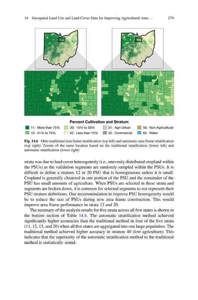
Fig. 14.6 Ohio traditional area frame stratification (top left) and automatic area frame stratification
(top right). Zooms of the same location based on the traditional stratification (lower left) and
automatic stratification (lower right)
14 Geospatial Land Use and Land Cover Data for Improving Agricultural Area. . .
279
the PSUs) as the validation segments are randomly sampled within the PSUs. It is
difficult to define a stratum 12 or 20 PSU that is homogeneous unless it is small.
Cropland is generally clustered in one portion of the PSU and the remainder of the
PSU has small amounts of agriculture. When PSUs are selected in these strata and
segments are broken down, it is common for selected segments to not represent their
PSU stratum definitions. One recommendation to improve PSU homogeneity would
be to reduce the size of PSUs during new area frame construction. This would
improve area frame performance in strata 12 and 20.
The summary of the analysis results for five strata across all five states is shown in
the bottom section of Table 14.4. The automatic stratification method achieved
significantly higher accuracies than the traditional method in four of the five strata
(11, 12, 13, and 20) when all five states are aggregated into one large population. The
traditional method achieved higher accuracy in stratum 40 (low agriculture). This
indicates that the superiority of the automatic stratification method to the traditional
method is statistically sound.
Fig. 14.6 Ohio traditional area frame stratification (top left) and automatic area frame stratification
(top right). Zooms of the same location based on the traditional stratification (lower left) and
automatic stratification (lower right)
14 Geospatial Land Use and Land Cover Data for Improving Agricultural Area. . .
279