

image that will darken bright areas of the image and lighten dark areas and shifting
the entire image toward a user-specified tonal center, usually a defined pixel value of
127. Most of the image acquisitions were realized between 10:00 and 15:00 hours.
Again, most of the aerial photography missions were realized between 15 July and
30 August in 2015, between 10:00 and 15:00 hours. Based on the pixel value
surveys, distribution in different geographical zones, and sun height angle, the
time of the mission is defined experimentally.
• Automatic Radiometric Correction.
OrthoVista v. 6.2.1 is a radiometric software product that improves the quality,
utility, and value of ortho-rectified digital image mosaics by performing a series of
radiometric adjustments designed to match color and intensity across component
images, producing seamless aerial image mosaics. OrthoVista removes solar reflection “hot spots” and improves visual uniformity and orthophoto mosaic by automatically balancing the intensity and color variation across each image. The software
compensates for various illumination effects by matching the color and intensity of
adjacent input images in order to provide smooth and consistent radiometric image
properties across all images.
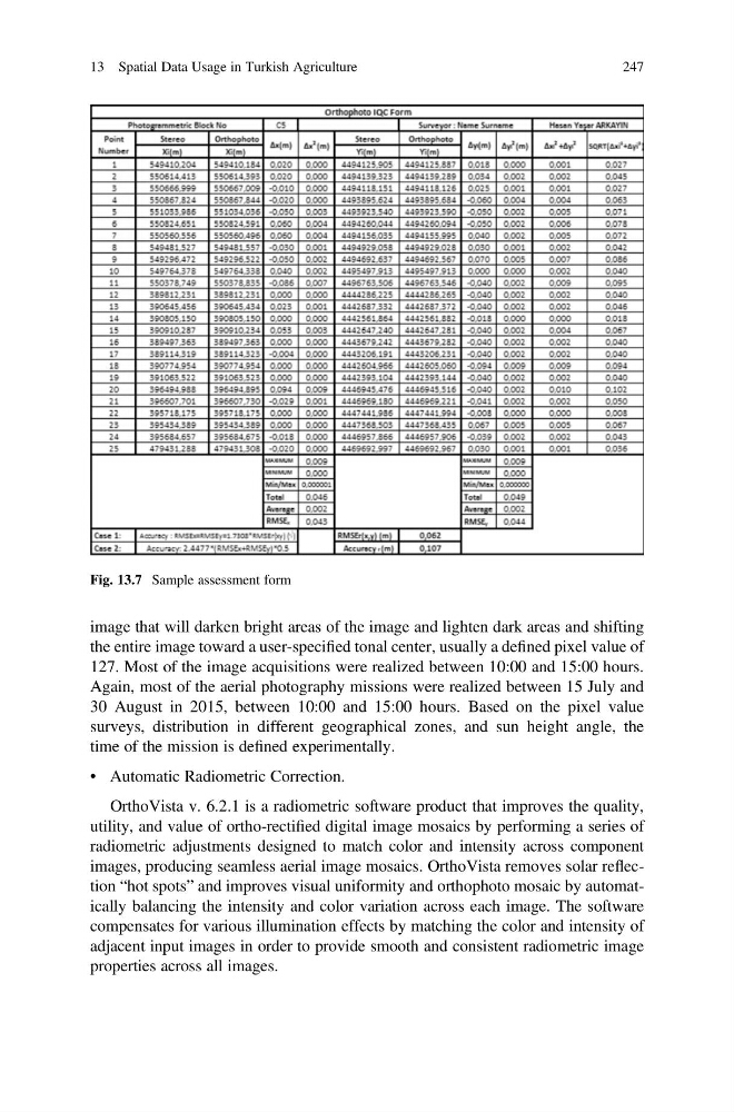
Fig. 13.7 Sample assessment form
13 Spatial Data Usage in Turkish Agriculture
247
the entire image toward a user-specified tonal center, usually a defined pixel value of
127. Most of the image acquisitions were realized between 10:00 and 15:00 hours.
Again, most of the aerial photography missions were realized between 15 July and
30 August in 2015, between 10:00 and 15:00 hours. Based on the pixel value
surveys, distribution in different geographical zones, and sun height angle, the
time of the mission is defined experimentally.
• Automatic Radiometric Correction.
OrthoVista v. 6.2.1 is a radiometric software product that improves the quality,
utility, and value of ortho-rectified digital image mosaics by performing a series of
radiometric adjustments designed to match color and intensity across component
images, producing seamless aerial image mosaics. OrthoVista removes solar reflection “hot spots” and improves visual uniformity and orthophoto mosaic by automatically balancing the intensity and color variation across each image. The software
compensates for various illumination effects by matching the color and intensity of
adjacent input images in order to provide smooth and consistent radiometric image
properties across all images.
Fig. 13.7 Sample assessment form
13 Spatial Data Usage in Turkish Agriculture
247